Zorats Karer
Armenia /
Syunik /
Shaki /
World
/ Armenia
/ Syunik
/ Shaki
World / Armenia
archaeological site, megalith, interesting place
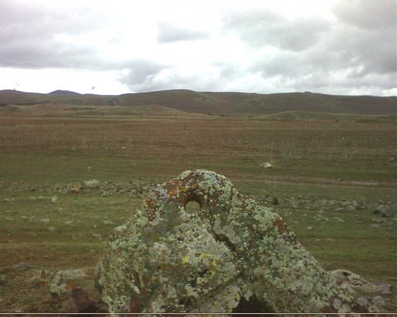
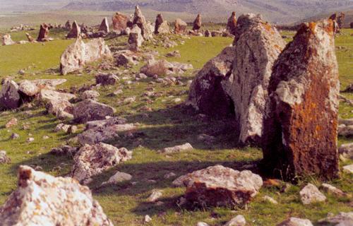
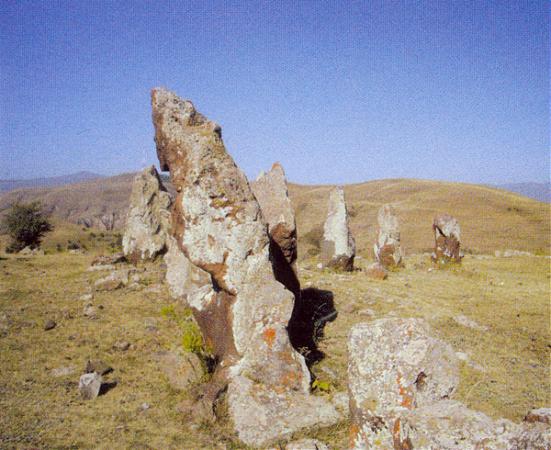
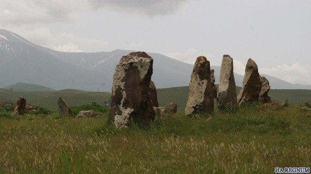
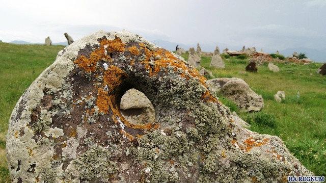
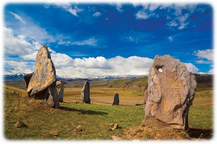
According to scientist’s findings, a temple consisting of 40 stones built in honor of the Armenians’ main God, Ari, meaning the Sun, is situated in the central part of Carahunge. Besides the temple, it had a large and developed observatory, and also a university that makes up the temple’s wings. The structure surrounds a Bronze Age cemetery set on a natural elevation. The site was in use from the Middle Bronze Age (2nd to 1st millennia BC), and contains some extraordinary chamber tombs. A wall of rocks and loam was built, of which only the vertical rocks remain standing. In the Hellenistic and Roman period, the site was probably used as a fortified place of refuge.
The site has some notability in archaeoastronomy, where it is interpreted as an "ancient observatory". Armenian physicist and archaeoastronomy enthusiast Paris Herouni dates it to 7,000 B.C.
The site has some notability in archaeoastronomy, where it is interpreted as an "ancient observatory". Armenian physicist and archaeoastronomy enthusiast Paris Herouni dates it to 7,000 B.C.
Wikipedia article: http://en.wikipedia.org/wiki/Zorats_Karer
Nearby cities:
Coordinates: 39°33'6"N 46°1'44"E
- Sevlich (Kara gol) lake 17 km
- Wings of Tatev 24 km
- Tatev Monastery 27 km
- Nabiyurd monastery 44 km
- Vayots Sar Volcano, 2586 m 54 km
- Ruines of Surb Astvatzatzni Metz Anapat monastery 66 km
- Surb Hakob Hayrapet - Armenian monastery 67 km
- Karmir Vank - Armenian monastery 73 km
- Church of the Holy Mother of God 80 km
- Çors 117 km
- Sisian Airstrip 2.5 km
- Gululu mt. 5.1 km
- Sisian Municipality 6.6 km
- Angeghakot reservoir 7.3 km
- Balak 8.4 km
- Arkhachtapa mt. 11 km
- Marz of Syunik 25 km
- Zangezur Mountains 27 km
- Lachin District 33 km
- Nakhchivan Autonomous Republic 56 km