Kille Rohida
India /
Maharashtra /
Bhor /
World
/ India
/ Maharashtra
/ Bhor
World / India / Maharashtra / Pune
hillfort
Add category
Rohida fort
Fort: Rohida aka Vichitragad aka Binicha Killa
Height : 3650 ft (above MSL)
Base village : Mankarwadi / Bajarwadi (near Bhor)
Grade : Easy
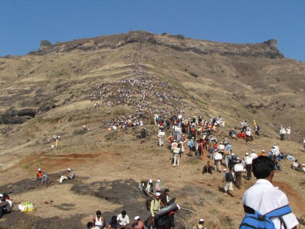
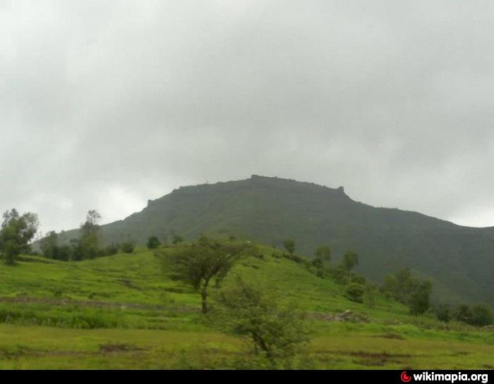
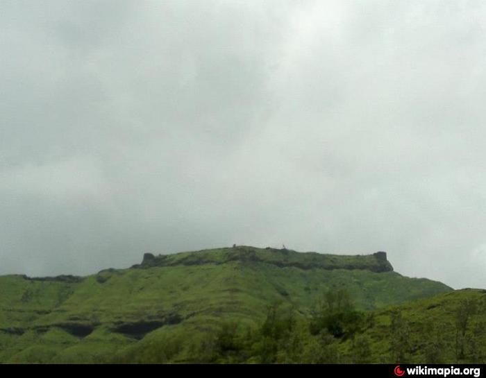
Rohida or Vichitragad is a fort situated about 15 Km from Bhor village. It is one of the southmost forts in Pune district. Rohida is barren in Summer or Winter but With monsoon it is filled with lush green grass.
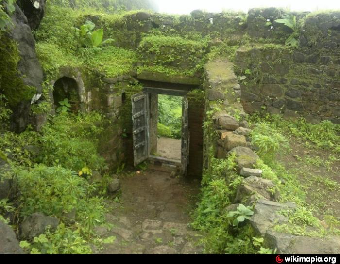
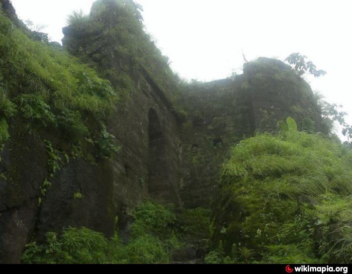
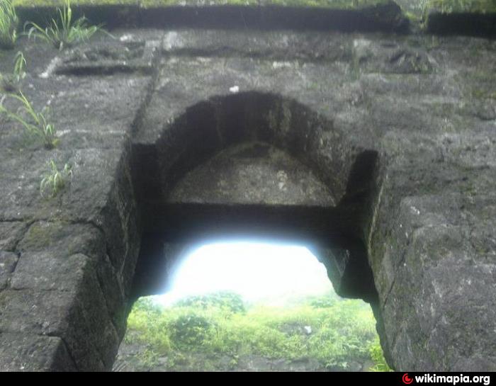
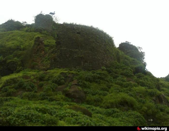
Rohida is famous for torrent wind !! If you haven't experienced the wind during monsoon months on Rohida fort then you don't know what it is !! Apart from this points of attraction are old temple, few big water tanks, Chor darvaja, Buruj (bastion) on North East Face, Chuna grinding wheel.
this fort is also called as WICHITRA GAD or BINICHA KILLA or ROHIDA.IT is related with SATWAHAN ERA (hitorians think so)this is near from BHOR.Krishnaji Bhaskar Kulkarni the lawyer of Afjal Khan was HAWALDAR of this fort.
Fort: Rohida aka Vichitragad aka Binicha Killa
Height : 3650 ft (above MSL)
Base village : Mankarwadi / Bajarwadi (near Bhor)
Grade : Easy
Rohida or Vichitragad is a fort situated about 15 Km from Bhor village. It is one of the southmost forts in Pune district. Rohida is barren in Summer or Winter but With monsoon it is filled with lush green grass.
Rohida is famous for torrent wind !! If you haven't experienced the wind during monsoon months on Rohida fort then you don't know what it is !! Apart from this points of attraction are old temple, few big water tanks, Chor darvaja, Buruj (bastion) on North East Face, Chuna grinding wheel.
this fort is also called as WICHITRA GAD or BINICHA KILLA or ROHIDA.IT is related with SATWAHAN ERA (hitorians think so)this is near from BHOR.Krishnaji Bhaskar Kulkarni the lawyer of Afjal Khan was HAWALDAR of this fort.
Nearby cities:
Coordinates: 18°6'10"N 73°49'15"E
- Rawala and Jawala forts Plateau 254 km
- Kille Dhodap 256 km
- Kille Ahivant 258 km
- Kille Mulher & Mora 298 km
- Mandu Fort 501 km
- Asirgarh 648 km
- Polonnaruwa Archaeological Complex 1369 km
- Gyaur Kala fortress (Seleucid-Sassanid era) 2456 km
- Sultan Kala Fortress (Abbasid/Seljuk era) 2458 km
- Tape Zaghe & Tape Ghabrestan & Ghare Tape- 7000 BC 3068 km
- Dhavle Wadi 1.2 km
- santosh.p.kondhalakar farm 1.4 km
- GENABA D. KONDHALKAR FARM 1.8 km
- Panvhal Villege 2.4 km
- nazare gaon 3.6 km
- Ananda Bhiku Mhaske 4 km
- Dhom balkwadi canal tunnel 4.7 km
- Bhor Taluka 9 km
- Wai Taluka 19 km
- Khandala Taluka 23 km