Hirtenfeld mit Kapelle / Shepherds Field (Latin) (Бейт-Сахур)
Palestine /
Bayt Lahhm /
Bayt Sahur /
Бейт-Сахур
World
/ Palestine
/ Bayt Lahhm
/ Bayt Sahur
, 2 km vom Zentrum (بيت لاحور)
Världen / Palästinensische Autonomiegebiete / Westjordanland
Christentum, archäologisches Gelände


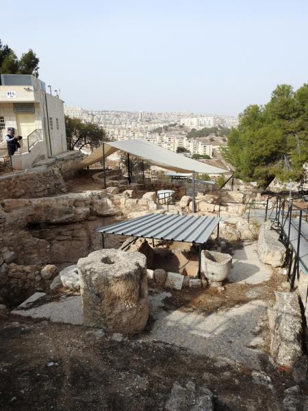

Ruins of a Byzantine monastery & church; ancient groto-chapels; modern chapel by Italian architect Antonio Barluzzi.
Nearby cities:
Koordinaten: 31°42'25"N 35°13'47"E
- Erlöserkirche 7.9 km
- Grabeskirche 8 km
- St.-Anna-Kirche 8.3 km
- Himmelfahrtkirche 9 km
- Machpela 23 km
- Latrun-Klosterkirche 28 km
- Klosterkirche 156 km
- Katharinenkloster (Sinai) 371 km
- Ost-Jerusalem 6.3 km
- Judäa 16 km
- Judäische Wüste 22 km
- Judäa und Samaria ("Westjordanland") 27 km