Altıntepe Tumulus
| archaeological site, tell (mound), barrow/tumulus/burial mound
Turkey /
Erzincan /
Uzumlu /
World
/ Turkey
/ Erzincan
/ Uzumlu
World / Turkey / Erzincan
archaeological site, tell (mound), barrow/tumulus/burial mound, do not draw title

www.youtube.com/watch?v=wpzHolN5_6Y&t=439s
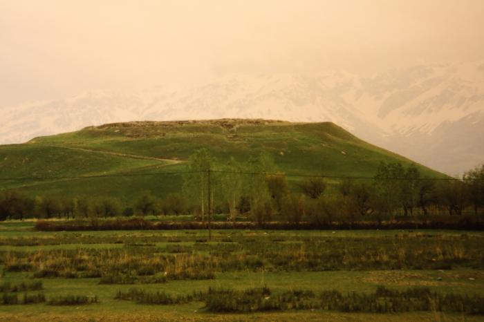
An ancient habitation mound some 12 km southeast of Erzincan. It features remains of buildings from the Urartian Iron Age (8th and 7th centuries BC) until the Byzantine Period.
Wikipedia article: https://en.wikipedia.org/wiki/Altıntepe
Nearby cities:
Coordinates: 39°41'47"N 39°38'48"E
- Satala 37 km
- Sadak 37 km
- Varzahan monastery 81 km
- Krom 99 km
- Santa 110 km
- Altındere National Park 116 km
- Bingöl Kalesi 117 km
- İncesu Kalesi 125 km
- Umudumtepe 142 km
- Kazancı Kalesi 171 km
- Wall
- Palace
- Cemetery 4 km
- Cemetery 5.1 km
- Cemetery 6.6 km
- Cemetery 6.7 km
- Cemetery 8 km
- Üzümlü District 21 km
- Erzincan Province 22 km
- Çayırlı District 33 km