Ir. H. Juanda Forest Park (TAHURA)
Indonesia /
Jawa Barat /
Lembang /
World
/ Indonesia
/ Jawa Barat
/ Lembang
World / Indonesia / Jawa Barat
park, monument, hill, playground, forest, fortification, wildlife protection/conservation

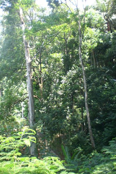


Ir. H. Juanda Forest Park (TAHURA = Taman Hutan Raya) is a conservation area that combines the secondary nature and pine (Pinus Merkusil) forest that is located in the sub-watershed Cikapundung, Citarum. This forest spreads out from Curug Dago, Dago Pakar to Maribaya, which is part of a group of forests on Pulosari Mountain make Ir. H. Djuanda Forest Park is the best place for eco-tourism as well as a place for the development of environmental education.
The potentials of TAHURA :
1. Flora and Fauna Potentials
2. Tourism Potentials
- Ir. H. Djuanda Monument and the surroundings
- Cibitung area and the surroundings
- Area between Dago Pakar and Maribaya
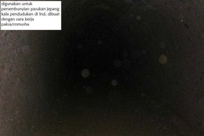
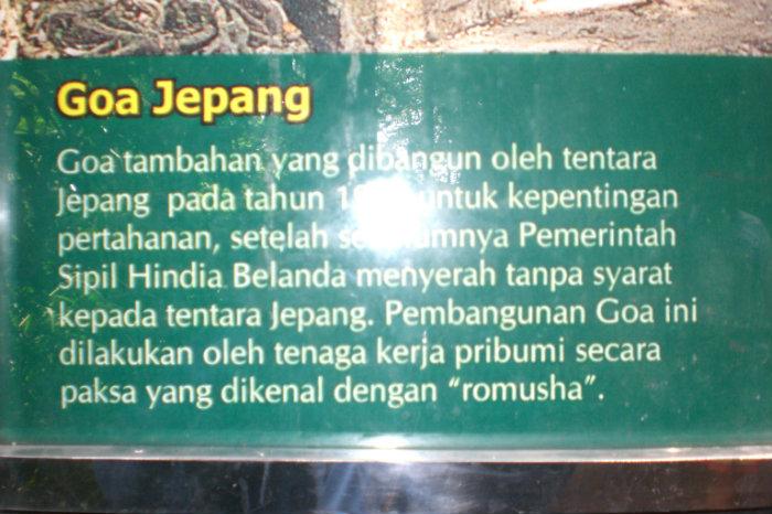
- Japan Cave and Dutch Cave Area
- Omas and Dago Waterfall
- “Kaulinan Sunda” Permanent stage
3. The availability of facilities and infrastructures Accessibility
The potentials of TAHURA :
1. Flora and Fauna Potentials
2. Tourism Potentials
- Ir. H. Djuanda Monument and the surroundings
- Cibitung area and the surroundings
- Area between Dago Pakar and Maribaya
- Japan Cave and Dutch Cave Area
- Omas and Dago Waterfall
- “Kaulinan Sunda” Permanent stage
3. The availability of facilities and infrastructures Accessibility
Nearby cities:
Coordinates: 6°50'45"S 107°38'37"E
- Desa Ciburial Kec. Cimenyan Kab. Bandung 2.5 km
- Forest 2.7 km
- Oray Tapa Ecotourism 3.1 km
- Masjid Agung Al-Jabbar (Masjid Terapung) 13 km
- Bandung Indah Golf & Big Water Park 17 km
- Gunung Kujang 25 km
- Kebun Kelapa Sawit 25 km
- Mt. Tampomas (1684 m) 35 km
- Mega Wisata Situ Nagrog Saradan 45 km
- Kawasan Hutan Lindung ( Perhutani ) 65 km
- Hidden Valley 0.7 km
- Pramestha Residences 1 km
- Pesantren Al Qur'an Babussalam Bandung 1.3 km
- Dago Dream Park 2 km
- Dago Pakar Resort 2.3 km
- Kompleks PPR-ITB 2.5 km
- Lembang 3.8 km
- Kec. Cidadap 4.2 km
- Lembang Fault 4.3 km
- West Bandung Regency 17 km