Walled perimeter of Rome in the IV century A.D. (Aurelian Walls) (Rome)
Italy /
Lazio /
Rome
World
/ Italy
/ Lazio
/ Rome
World / Italy / Lazio / Roma
draw only border, historical layer / disappeared object
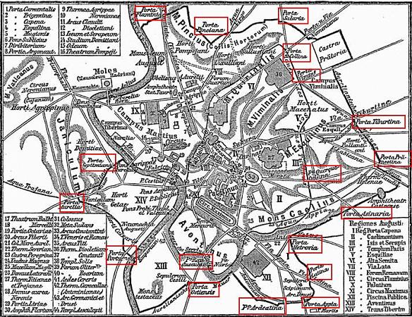


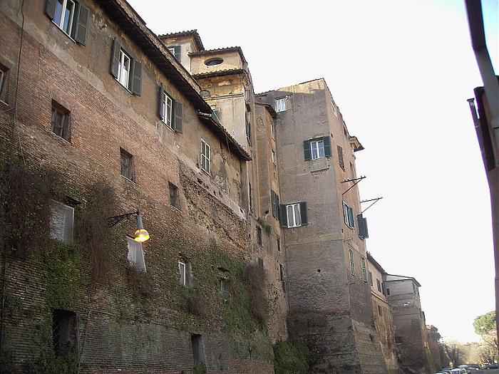
The Aurelian Walls (Italian: Mura aureliane) were city walls built between 271 and 275 in Rome during the reign of the Roman Emperors Aurelian and Probus. They enclosed all seven hills of Rome plus the Campus Martius and the Trastevere district on the left bank of the Tiber. The river banks within the city limits appear to have been left unfortified, though the riverside was certainly fortified along the Campus Martius.
The full circuit ran for 19 km (12.5 miles), surrounding an area of some 13.7 km² (5.3 square miles). The walls were constructed in brick-faced concrete, 3.5 m (11.5 ft) thick and 8 m (26.2 ft) high, with a square tower every 100 Roman feet (29.6 m / 97.1 ft). Remodelling in the 5th century doubled the height of the walls to 16 m (52 ft), by which time the circuit possessed 383 towers, 7,020 crenellations, 18 main gates, 5 posterns, 116 latrines and 2,066 large external windows
The full circuit ran for 19 km (12.5 miles), surrounding an area of some 13.7 km² (5.3 square miles). The walls were constructed in brick-faced concrete, 3.5 m (11.5 ft) thick and 8 m (26.2 ft) high, with a square tower every 100 Roman feet (29.6 m / 97.1 ft). Remodelling in the 5th century doubled the height of the walls to 16 m (52 ft), by which time the circuit possessed 383 towers, 7,020 crenellations, 18 main gates, 5 posterns, 116 latrines and 2,066 large external windows
Wikipedia article: http://en.wikipedia.org/wiki/Aurelian_Walls
Nearby cities:
Coordinates: 41°53'33"N 12°29'24"E
- Rome 15 km
- Municipio IV 21 km
- Nettuno 41 km
- Fucine Lake 81 km
- Fondi Municipality 85 km
- Province of Terni 87 km
- Orvieto 111 km
- Sessa Aurunca Municipality 123 km
- Foligno Municipality 132 km
- Pienza Municipality 157 km
- Palatine Hill 0.5 km
- Monti 0.5 km
- Campitelli 0.5 km
- Capitoline Hill 0.7 km
- Forum Boarium 0.8 km
- Caelian Hill 0.8 km
- The Jewish Ghetto 1 km
- Ripa 1.1 km
- Aventine Hill 1.3 km
- Celio 1.3 km