Zalabiye Fortress
Syria /
Dayr-az-Zawr /
Dayr az-Zawr /
World
/ Syria
/ Dayr-az-Zawr
/ Dayr az-Zawr
, 43 km from center (دير الزور)
World / Syria / Dayr Az Zawr
fortress, Roman Empire, historic ruins
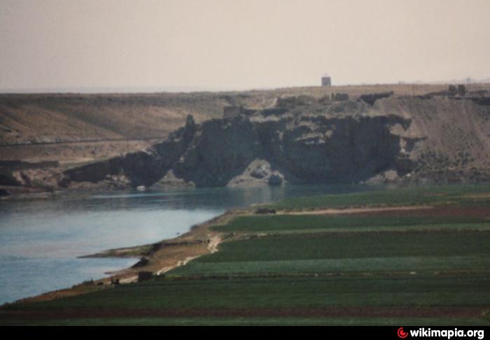
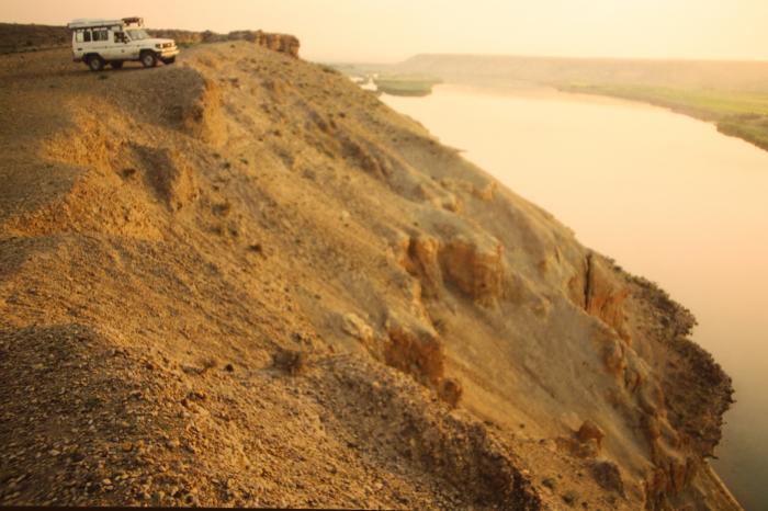
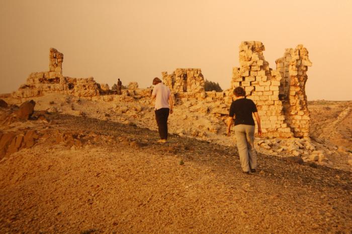
Fortress established by the Palmyrenes when they were trying to assert control to test Roman dominance. Later, the Romans used it to establish control of the Euphrates together with Halabiye/Zenobia-Fortess (couple of kms to the east on opposite bank). Destroyed like Zenobia in 610 by the Sassanides.
Wikipedia article: http://en.wikipedia.org/wiki/Zalabiye
Nearby cities:
Coordinates: 35°40'8"N 39°50'32"E
- Fortification Wall 226 km
- Sīrrūs/Cyrrhus/Qal‘at Nabī Hūrī 286 km
- Ancient Arzan 292 km
- Ruins of Anazarbus 396 km
- Caesarea Maritima 576 km
- Sagalassos (Pisidian) 862 km
- Mons Claudianus Quarries 1157 km
- Ancient Maronia 1379 km
- Byzantine Walls 1577 km
- Battle of Pydna (June 22, 168 BC) 1597 km
- Isharat al-Abbush 2.5 km
- Waterpipeline 2.7 km
- Cemetery 3 km
- Khanuqa/Strangler gorge 3.7 km
- Primitive oil wells and refinery 5.9 km
- Kulayb Hammah plateau (376 m) 5.9 km
- Al-Tabni Subdistrict 10 km
- Hammat al-Jazirah 12 km
- Deir ez-Zor Civil Council (DFNS) 67 km
- Deir ez-Zor Governorate (PCS) 87 km