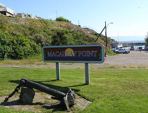
Macaulay Point Park (Victoria)
Canada /
British Columbia /
Victoria
World
/ Canada
/ British Columbia
/ Victoria
World / Canada / British Columbia / Capital
park
Add category

Macaulay Point began as a Hudson Bay farm, then later became part of Fort Macaulay. It has been managed as a municipal park since 1985.
This 7.6 hectare park is popular with birdwatchers, hikers and dog walkers. Native vegetation is mixed with grasses, plantain, and common cat’s ear. A remarkable array of plants has adapted, including roses, lupins, gumweed, wild onions and biscuit roots. At the eastern limit of the park boundary, a small grove of trembling aspens grows.
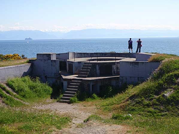
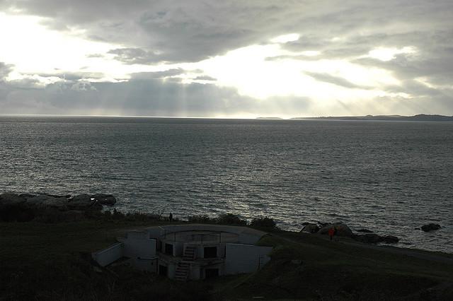
A number of trails and access points lead to views of the Strait of Juan de Fuca, as well as former military ramparts. Bunkers, lookouts and defensive berms give the park an historic look.
The park is home to rare and endangered plant species protected under Canada's Species At Risk Act. Visitors and their dogs are required to stay on designated paths to help protect this fragile area.
Macaulay Point can be accessed from Fleming Beach, as well as from Clifton Terrace off Munro Street.
This 7.6 hectare park is popular with birdwatchers, hikers and dog walkers. Native vegetation is mixed with grasses, plantain, and common cat’s ear. A remarkable array of plants has adapted, including roses, lupins, gumweed, wild onions and biscuit roots. At the eastern limit of the park boundary, a small grove of trembling aspens grows.
A number of trails and access points lead to views of the Strait of Juan de Fuca, as well as former military ramparts. Bunkers, lookouts and defensive berms give the park an historic look.
The park is home to rare and endangered plant species protected under Canada's Species At Risk Act. Visitors and their dogs are required to stay on designated paths to help protect this fragile area.
Macaulay Point can be accessed from Fleming Beach, as well as from Clifton Terrace off Munro Street.
Nearby cities:
Coordinates: 48°25'6"N 123°24'37"W
- Beacon Hill Park 3.1 km
- Coburg Peninsula 4.8 km
- Royal Roads University and Hatley Park National Historic Site 6.3 km
- Mill Hill Regional Park 7.5 km
- Mount Wells Regional Park 12 km
- Matheson Lake Regional Park 16 km
- Roche Cove Regional Park 17 km
- Sooke Mountain Provincial Park 20 km
- Sea-to-Sea Regional Park Reserve 21 km
- East Sooke Regional Park 23 km
- Macauley Point 0.4 km
- Work Point Barracks 0.8 km
- Naval Officer Training Center - VENTURE 1.2 km
- Inner Harbour 1.6 km
- Old Esquimalt 1.6 km
- Brothers Islands 1.7 km
- Esquimalt 1.8 km
- CFB Esquimalt--Dockyard 2 km
- The Gorge Waterway / Portage Inlet 3.1 km
- Esquimalt Harbour 3.5 km