Black Hand Gorge
USA /
Ohio /
Hanover /
World
/ USA
/ Ohio
/ Hanover
World / United States / Ohio
canyon / gorge, tunnel, interesting place, draw only border
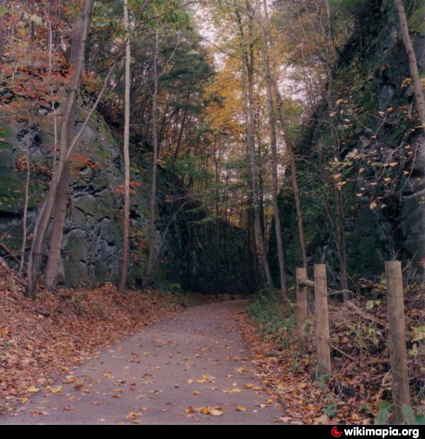
Black Hand Gorge is a narrow passage through which the Licking River flows. On the north side of the gorge is an abandoned interurban tunnel. The gorge was named after the Black Hand, a prehistoric drawing of a black hand painted on the walls of the gorge. The hand had its fingers spread, and part of a wrist was drawn. Supposedly one elongated finger pointed towards a nearby Indian Mound. It is thought that the symbol meant that all tribes passing through the gorge on their way to the flint pits a few miles south must pass through in peace. The drawing, which was just one of several, was destroyed in 1828 during the construction of the Ohio and Erie Canal. Other petroglyphs survived until 1890, many recorded by Dr.James Salisbury and his brother Charles, of Newark, who deposited their tracings and notes with the American Antiquarian Society in Massachusetts.
Blasting for the electric interurban railway in 1890 removed the last traces of almost all prehistoric stone carving. In October, 1890 an electric interurban was running from Newark to Granville. The line wasn't opened to Zanesville until 1903 due to difficulties cutting a pathway through the gorge. An interurban tunnel 19-1/2 feet high and 327 feet (100 m) long was blasted through solid rock to complete the job. The interurban ran on the opposite side of the Licking River from the B&O Railroad. The interurban was short lived due to the rising popularity of the automobile. The last Ohio Electric Interurban car ran through the gorge on February 15, 1929.
On July 4, 1825 Governors Clinton of New York and Morrow of Ohio threw the first shovel fulls of dirt at the Licking Summit near Newark, Ohio on the Ohio and Erie Canal project. Due to lack of transportation, Ohio farmers were essentially unable to sell their goods at any price, and Ohio was mired in a cash-poor depression. The canal would connect farmers to Lake Erie and the Ohio River.
The specifications for the canal required a width of 40 feet (12 m) at the top and 26 feet (7.9 m) at the bottom. The depth was to never be less than 4 feet (1.2 m). From the Licking Summit the canal proceeded east along the north side of the Licking River, crossed Rocky Fork Creek on an aqueduct. An inlet lock then connected the canal to the Licking River, which due to the sandstone formations, was the only way to get through the Blackhand Gorge.
(credit Wikipedia)
Wikipedia article: http://en.wikipedia.org/wiki/Blackhand_Gorge_State_Nature_Preserve
Nearby cities:
Coordinates: 40°3'10"N 82°14'36"W
- Red River Gorge 277 km
- Smoke Hole 280 km
- Pine Creek Gorge ("Grand Canyon of Pennsylvania") 439 km
- Hickory Nut Gorge 508 km
- Baltimore Canyon 748 km
- Ahonda canyon 4261 km
- Eldgjá 4822 km
- Eldgjá 4830 km
- Canón do Sil 6031 km
- Akka Lekandrat 6738 km
- Hanover Township 0.8 km
- Hopewell Township 7.3 km
- Dillon State Park 8.4 km
- Perry Township 8.9 km
- Bowling Green Township 14 km
- Fallsbury Township 17 km
- Pike Township 19 km
- Madison Township 21 km
- Hopewell Township 21 km
- Perry County 35 km