Águas Claras
Brazil /
Distrito Federal /
Brasilia /
World
/ Brazil
/ Distrito Federal
/ Brasilia
World / Brazil / Distrito Federal / Brasília
city, draw only border
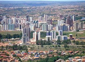

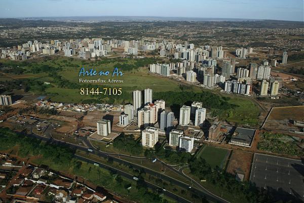


Águas Claras is an administrative region of the Federal District, Brazil, and has an area of 808 hectare, twenty kilometers away from the Brasília. It was designed by architect and town planner Paul juniper and began to be built in the 1990s and is classified as administrative region since 2003 by a law district. Its estimated population in 2008 was 110 thousand inhabitants. It has an area of 8.08 square kilometers.
Official page: www.aguasclaras.df.gov.br
Official page: www.aguasclaras.df.gov.br
Nearby cities:
Coordinates: 15°49'56"S 48°1'32"W
- Federal District 46 km
- Luziânia 51 km
- Unaí 61 km
- Corumbá de Goiás 95 km
- Cocalzinho de Goiás 104 km
- Mimoso de Goiás 129 km
- Pirenópolis 133 km
- Vila Boa 155 km
- Goianésia 171 km
- Itapuranga 236 km
- Official Residence of Águas Claras 0.5 km
- Boy Scout Group 0.5 km
- Parque Central Águas Claras 1 km
- Quadra 202, 3 1.4 km
- La Salle School - Águas Claras 1.5 km
- Rua 4C Chácara 2 1.6 km
- Rua 4 Chácara 9 1.9 km
- Rua 4 Chácara 8 1.9 km
- Feira do Produtor Rural de Vicente Pires - ARVIP 2.4 km
- South Taguatinga 3.6 km