Fürth Rathaus (Fürth)
Germany /
Bayern /
Furth /
Fürth /
Königstraße
World
/ Germany
/ Bayern
/ Furth
World / Germany / Bayern / Mittelfranken
administrative building, clock tower, guildhall, listed building / architectural heritage, 1840s construction


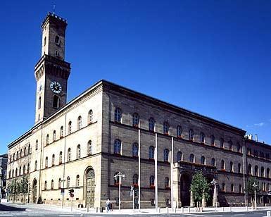
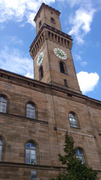


town hall
Nearby cities:
Coordinates: 49°28'38"N 10°59'20"E
- Nuremberg new town hall 6.8 km
- Nuremberg old town hall - Lochgefaengnisse 6.8 km
- Rathaus 6.9 km
- City Hall Stein 7.3 km
- Federal Office for Migration and Refugees 9 km
- Autobahndirektion Nordbayern - Autobahnmeisterei Fischbach 16 km
- Town Hall 60 km
- Old Town Hall 66 km
- Gasuf - Gasversorgung Unterfranken GmbH 80 km
- Rathaus Würzburg 84 km
- Pedestrian zone 0.3 km
- Car park 0.5 km
- Wöhrl fashion shop 0.6 km
- Fürther Freiheit 0.7 km
- Bridge 0.8 km
- Bahnhof Fürth 0.8 km
- City cemetery 1.2 km
- Trolli Arena 1.3 km
- Selgros - alte Ikea 1.4 km
- Ikea Fürth 1.7 km