Former site of the Lexington Bridge
USA /
Missouri /
Lexington /
World
/ USA
/ Missouri
/ Lexington
World / United States / Missouri
bridge, historical layer / disappeared object
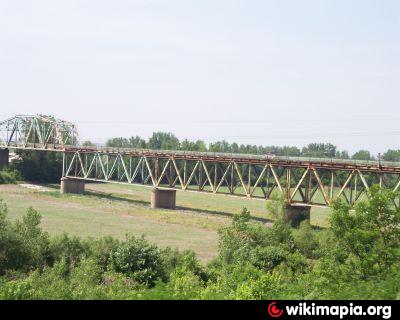
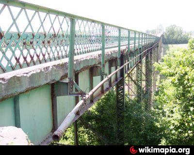

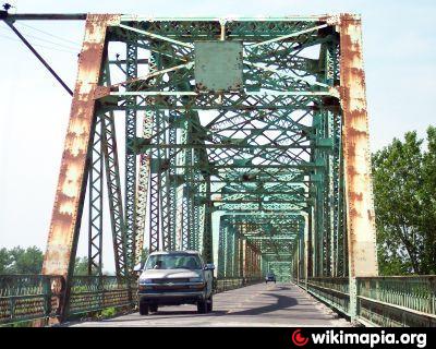
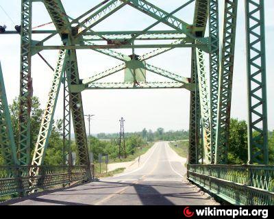
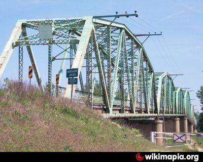
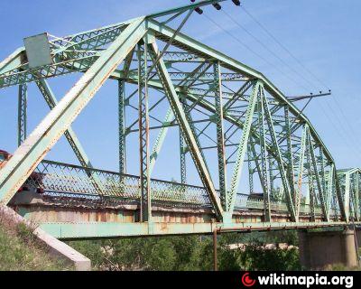
The Lexington Bridge was the link between the Ray County and Lafayette County, Missouri at Lexington, MO and carried MO 13 over the Missouri River. A seven span truss, The main span was 408 feet and the total length was 3,072.4 feet. Its deck width was 20 feet and it had vertical clearance of 18.1 feet.
It opened on October 31, 1924 and was replaced by the Ike Skelton Bridge on June 25, 2005.
It opened on October 31, 1924 and was replaced by the Ike Skelton Bridge on June 25, 2005.
Wikipedia article: http://en.wikipedia.org/wiki/Lexington_Bridge_(Lexington,_Missouri)
Nearby cities:
Coordinates: 39°11'10"N 93°53'44"W
- BNSF Sibley Bridge 25 km
- Harry S. Truman Bridge 51 km
- Sheffield Flyover 54 km
- Christopher S. Bond Bridge 58 km
- Highline Bridge (Kansas City Terminal Railway, KCTR) 63 km
- Lewis and Clark viaduct 63 km
- 23rd Street viaduct 63 km
- I-670 viaduct 64 km
- Interstate 635 viaduct 68 km
- The One Bridal, LLC 82 km
- Hardin Conservation Area 8.8 km
- Harry S. Truman Regional Airport 25 km
- Ferguson-Herold Conservation Area 28 km
- Lake City Ammunition Plant 32 km
- Powell Botanical Gardens 37 km
- Edwin A Pape Lake 38 km
- Hazel Hill Lake Conservation Area 39 km
- Lone Jack Conservation Area 42 km
- Ralph and Martha Perry Memorial State Wildlife Area 44 km
- Leesville State Wildlife Area 45 km
Hardin Conservation Area
Harry S. Truman Regional Airport
Ferguson-Herold Conservation Area
Lake City Ammunition Plant
Powell Botanical Gardens
Edwin A Pape Lake
Hazel Hill Lake Conservation Area
Lone Jack Conservation Area
Ralph and Martha Perry Memorial State Wildlife Area
Leesville State Wildlife Area