Rausor Dam
Romania /
Arges /
Leresti /
World
/ Romania
/ Arges
/ Leresti
World / Romania
dam
Add category
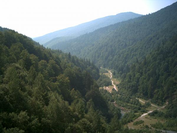
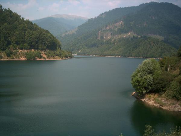
Hidroenergetic construction built in 1987 on Târgului River, near Câmpulung Mușcel Municipality, Argeș County.
Access:
> via National Road no. 73 (DN 73), either coming from Brașov or Pitești/Târgoviște;
> then taking County Road no. 734 (DJ 734) through Lerești (look for the sign indicating Voina Chalet - ”Cabana Voina” - in the traffic lights based intersection);
Access road quality and other information:
> county road largely made of asphalt, but badly neglected. It has: holes in the asphalt and bumps and a portion of gravel;
> dangers: at the end of Lerești there is a gipsy colony and there is the real threat of coliding with animals or children which may be on the road;
Nearby cities:
Coordinates: 45°23'34"N 25°3'45"E
- Hydroelectric Dam and Spillway 11 km
- Siriu reservoir 90 km
- Siriu Dam (122m) 93 km
- Lake Gura Râului 98 km
- Ighis Dam 101 km
- Barajul Valea Uzului 147 km
- Tailing pond 174 km
- Baraj Gura Apelor (168m) 183 km
- Barajul si CHE Racaciuni(1984) 185 km
- oraşul Bicaz 186 km
- Rausor Lake 2.4 km
- Voina Chalet 5.2 km
- Vacarea sheepfold 6.1 km
- Ob. Pl.1 6.1 km
- Iezer-Papusa Mountain Group 6.3 km
- Automobile bridge 6.7 km
- Automobile bridge 8.4 km
- Automobile bridge 8.8 km
- Iezer Lake 11 km
- Făgăraş Mountains 34 km