Budaun
India /
Uttar Pradesh /
Budaun /
World
/ India
/ Uttar Pradesh
/ Budaun
World / India / Uttar Pradesh / Badaun
city, municipality, taluka headquarter, district headquarter
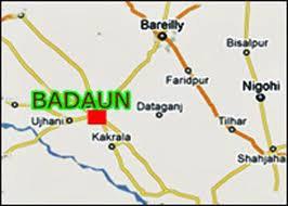

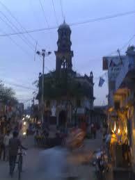
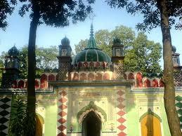
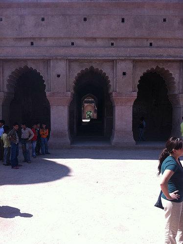
Badaun is a city and Nagar Palika in Badaun Block Badaun Tehsil in Badaun District of Uttar Pradesh. It is also the headquarter of Badaun District and an ancient town situated 197 km east of New Delhi, in northern Uttar Pradesh. It is a major center of agricultural in the district. The town also boasts some small-scale industries as well. The origin of Budaun dates back to 900AD, when the town was built around a fort, which is now in ruins. As per an ancient write up, which is now preserved in the Lucknow museum, the town was called ‘Boda Mayoota’ in the 11th century. Muslims invaded Budaun in 1196. It was a major frontier outpost of the Muslim kingdom of Delhi in the 13th century. They remained in the seat of a provincial governorship until being replaced in 1657. Budaun came under the British rule in 1801 and remained with them until India’s independence in 1947. Also is the birth place of Nizamuddin Aulia and Razia Sultan. Places of tourist interest include the 13th century Jamia Mosque and the remains of the 10th century fort. Nearest international airport is at New Delhi. Budaun Railway Station is on the Mathura-Bareilly line. Regular buses are available to Aligarh (98 km),Bareilly (45 km), Etah (117 km) and Lucknow (220 km).
Wikipedia article: http://en.wikipedia.org/wiki/Budaun
Nearby cities:
Coordinates: 28°1'51"N 79°8'3"E
- Bareilly 50 km
- Farrukhabad 81 km
- Rudrapur 114 km
- Haldwani 140 km
- Mahendra Nagar 151 km
- Dhangadhi 160 km
- Gonda 290 km
- Butwal 422 km
- Siddharthanagar 424 km
- Pokhara 474 km
- Awas Vikas Colony 1.3 km
- Sagar Tal 2.3 km
- Barah Paththar 2.9 km
- Budaun City Expansion II 3.4 km
- Budaun City Expansion III 4 km
- kulchaura village 4.3 km
- kulchoura 5.4 km
- Utarana 12 km
- Dugraiyya Brahmpur Village 12 km
- Chakolar 13 km
Comments