Muzhappilangad Drive-In-Beach
India /
Kerala /
Muzhappilangad /
World
/ India
/ Kerala
/ Muzhappilangad
World / India / Kerala / Wayanad
beach, island, interesting place, train station


Muzhappilangad-Edakkad Drive - In Beach.:: www.muzhappilangadtourism.com
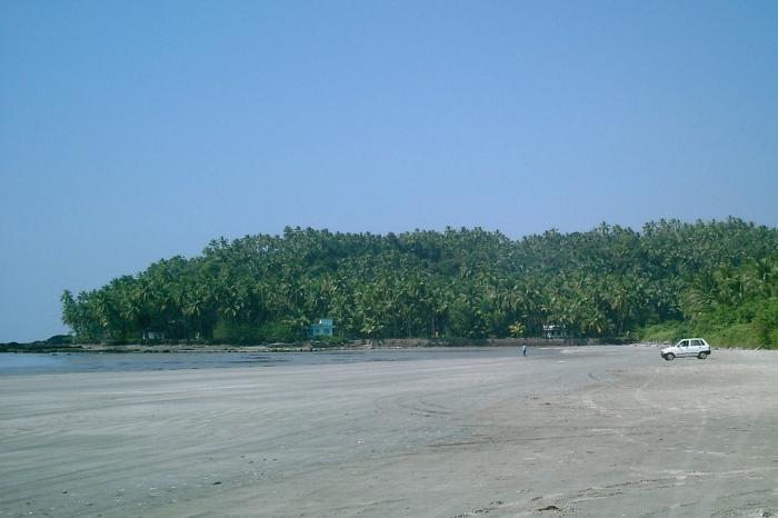
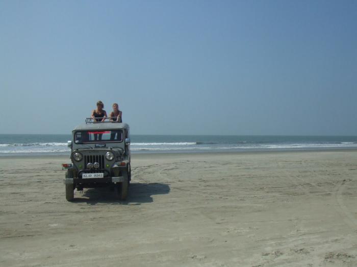
Muzhappilangad-Edakkad Beach is 15 km South of Kannur and only 8 km from Thalassery Beach. Black rocks protect Muzhappilangad from the current of the deep, making its shallow water a swimmer's paradise. This beautiful beach is the only drive-in beach in God’s own country . Believe it or not, you can drive down the entire 5 km length .A unique treat to your senses.
Muzhappilangad is a small coastal village in Kannur district in the Indian state of Kerala. From Muzhappilangad you can see the Dharmadam island (Pacha Thuruth) just across the Ancharakkandy river.
The nearest town to Muzhappilangad is Thalassery which is 7 km away. The District Headquarters Kannur is about 13 km from Muzhappilangadu.
Muzhappilangadu is famous for "Thalappoli", a local three day festival celebrated in March in "Sree Koormba Temple". In this festival devotees take Kalasham (a sacred brass receptacle) and walk kilometers to the Temple to show their respect to the Goddess.
Demographics
As of 2001 India census[1], Muzhappilangad had a population of 21,905. Males constitute 47% of the population and females 53%. Muzhappilangad has an average literacy rate of 83%, higher than the national average of 59.5%: male literacy is 84%, and female literacy is 83%. In Muzhappilangad, 12% of the population is under 6 years of age.
Coordinates: 11°48′N, 75°27'
Nearby cities:
Coordinates: 11°47'43"N 75°26'22"E
- Kizhunna Beach 5.4 km
- Payyambalam Beach 14 km
- Payyambalam beach 17 km
- Choottad Beach 34 km
- MADAKKAL 47 km
- Valiyaparamba 52 km
- Valiyaparamba Island 57 km
- Veer Savarkar Beach Kavugoli. 99 km
- Manjeshwar Beach 121 km
- Kemmannu Paradise of 4 beaches 201 km
- Muzhappilangand Cemetery 0.4 km
- Sreeram Nagar 0.7 km
- Kulam Bazar 1.1 km
- CEE PEE HOUSE 1.2 km
- FCI Junction 1.3 km
- FCI, Muzhappilangad 1.5 km
- Sree Narayana Madom Junction 1.6 km
- Sree Koormba Bagavathi Temple Compound 1.6 km
- Muzhppilangad Beach Rocks. 1.6 km
- Edakkad Panchayath 1.7 km
Comments