Chapel Falls
USA /
Michigan /
Munising /
World
/ USA
/ Michigan
/ Munising
World / Canada / Ontario / Lake Superior
waterfall
Add category
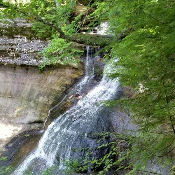
Accessible from Chapel Road by foot trail (approx. 1.8 miles).
www.nps.gov/piro/planyourvisit/waterfalls.htm#Chapel_Fa...
www.alltrails.com/trail/us/michigan/mosquito-falls-and-...
caltopo.com/map.html#ll=46.52931,-86.44578&z=16&b=t
www.nps.gov/piro/planyourvisit/waterfalls.htm#Chapel_Fa...
www.alltrails.com/trail/us/michigan/mosquito-falls-and-...
caltopo.com/map.html#ll=46.52931,-86.44578&z=16&b=t
Nearby cities:
Coordinates: 46°31'43"N 86°26'38"W
- Falls Reserve Conservation Area 489 km
- Port Sydney, Ontario 572 km
- Letchworth State Park 786 km
- Smiths Falls-Montague Airport 833 km
- Bash Bish Falls State Park 1140 km
- Parc de la Chute-Montmorency 1166 km
- Sculptured Rocks Natural Area 1185 km
- Anderson Brook 1202 km
- Wadsworth Falls State Park 1230 km
- Devil's Hopyard State Park 1257 km
- Pictured Rocks National Lakeshore 11 km
- Grand Island 17 km
- Grand Marais 39 km
- Seney National Wildlife Refuge 41 km
- Hiawatha National Forest 55 km
- Manistique Lake 60 km
- Skandia Township 60 km
- Chocolay Charter Township 61 km
- Turin Township 72 km
- Carmeuse Lime & Stone Port Inland Quarry & Port 72 km