vulytsia Prorizna (Kyiv)


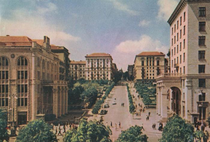

The first reference to the street was found on an 1848 Kiev city map. It was originally named "Martynivska Street." In the 1850s, the street was also known under two additional names: Zolotokhreschenska and Prorizna. From 1863 to 1919, the street was officially named Vasylchykovska, after Kyiv General-Governor I.I.Vasylchikov. However, its current name, Prorizna, was also widely used. From 1919 until 1990, the street was named after Bolshevik leader Yakov Sverdlov. It was damaged in 1941 and remained ruined during the German occupation of Kiev, from 1941 to 1943, being eventually restored after World War II.
The street officially changed to its historical name, Prorizna, in 1990. Adjoining streets are: Pushkinska, Borysa Grinchenka and Patorzhinskogo. There is also another Prorizna Street in Kiev, located in Kiev's Bilychi suburb.
The street officially changed to its historical name, Prorizna, in 1990. Adjoining streets are: Pushkinska, Borysa Grinchenka and Patorzhinskogo. There is also another Prorizna Street in Kiev, located in Kiev's Bilychi suburb.
vulytsia Prorizna, related objects
Wikipedia article: http://en.wikipedia.org/wiki/Prorizna_Street
Nearby cities:
Coordinates: 50°26'54"N 30°31'5"E
- vulytsia Volodymyrska, 49a 0.2 km
- Zoloti Vorota metro station 0.3 km
- Security Service of Ukraine 0.3 km
- Old Kyiv 0.6 km
- Central Park 1.6 km
- Pecherskyi raion 3 km
- Lybid River 3.8 km
- Shevchenkivskyi raion 4.3 km
- Solomianskyi raion 5.3 km
- Kaniv Reservoir 48 km
- vulytsia Naberezhno-Khreshchatytska 2.2 km
- Naberezhne shose 2.3 km
- vulytsia Feodosiiska 5.4 km
- vulytsia Velyka Kytaivska 5.4 km
- vulytsia Viktora Zabily 5.4 km
- Stratehichne shose 5.6 km
- vulytsia Pavla Hrabovskoho 5.8 km
- prospekt Nauky 6.8 km
- Beresteiskyi prospekt 7.4 km
- Stolychne shose 18 km