Site of USAir Flight 1016 Crash
USA /
North Carolina /
Mount Holly /
Wallace Neel Rd.
World
/ USA
/ North Carolina
/ Mount Holly
World / United States / North Carolina
crash site, aeroplane, historical layer / disappeared object
July 2, 1994
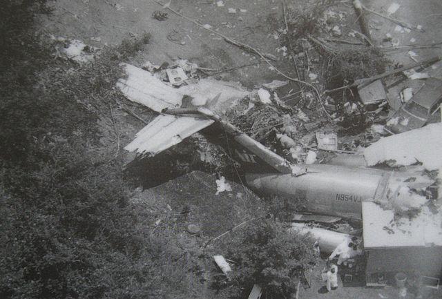
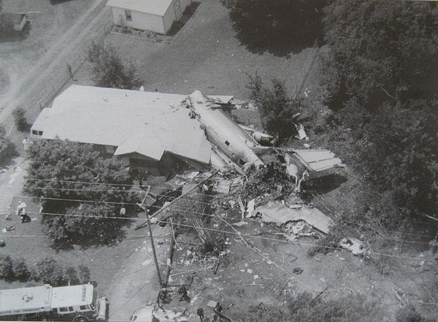
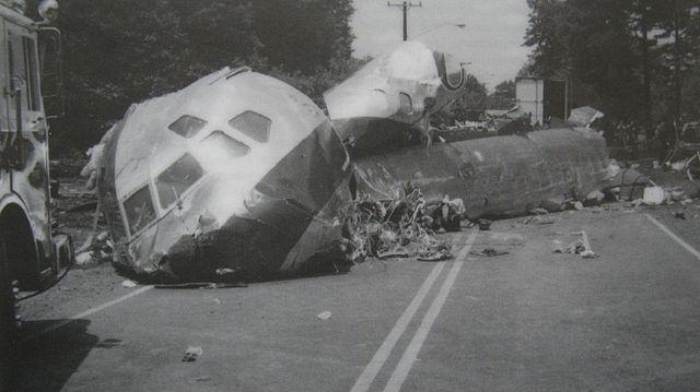
Flight 1016 from Columbia, SC to Charlotte, NC crashed during a thunderstorm on approach to Charlotte-Douglas International Airport, killing 37. Cause was wind shear.
Flight 1016 from Columbia, SC to Charlotte, NC crashed during a thunderstorm on approach to Charlotte-Douglas International Airport, killing 37. Cause was wind shear.
Wikipedia article: http://en.wikipedia.org/wiki/USAir_Flight_1016
Nearby cities:
Coordinates: 35°13'15"N 80°57'38"W
- 1958 Tybee Island mid-air collision 365 km
- Place of death of the submarine "Thresher" 1466 km
- Approximate Crash Site Birgenair 757 Flight 301 February 6,1996 1989 km
- Last known position of the "Andrea Gail" 2389 km
- Wreck of Soviet Submarine K-219 2468 km
- RMS Titanic (point of collision) 2778 km
- Approximate landing area of the "Lost Squadron" of 1942 4280 km
- HMS Audacious (Wreck) 5861 km
- RMS Lusitania (WWI Ocean Liner Wreck) 5875 km
- 1966 Palomares B-52 crash 6886 km
- Charlotte / Douglas International Airport (CLT/KCLT) 1.6 km
- The Vineyards on Lake Wylie 3.4 km
- Dixie / Berryhill 3.8 km
- Harbor House 4.2 km
- Pawtuckett 4.3 km
- Berewick Community 6.7 km
- Steele Creek 12 km
- Lake Wylie 12 km
- Mecklenburg County, North Carolina 15 km
- Gaston County, North Carolina 22 km