Black Rock Point Lighthouse
United Kingdom /
England /
North Sunderland /
World
/ United Kingdom
/ England
/ North Sunderland
World / United Kingdom / England
lighthouse
Add category

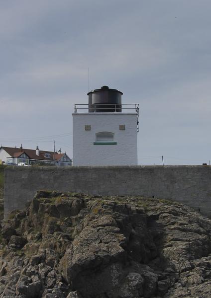
Established 1910
Height Of Tower 9 Metres
Height Of Light Above Mean High Water 12.5 Metres
Electrified 1964
The dangers of the North East coast have long since been noted, although no warnings or safety precautions were apparently employed until the late 18th century. The turbulence of the waters, however, can be matched by the turbulence of the area's history.
The Bamburgh area, and Bamburgh Castle in particular, has played an important role in English history since the occupation of the site by the Romans. Only 20 miles from the border Bamburgh Castle was once captured by the Scots and has also been fought over by the Danes and the Kings of Mercia and Northumbria.
By the late 18th century Bamburgh Castle had fallen into disrepair and became a charity school run by a Doctor Sharp, who also instituted various measures for the benefit of passing mariners. He set up an elementary lifeboat station in Bamburgh Village, operated a warning system of bells and guns from the Castle ramparts, and whilst gales persisted, employed 2 riders to patrol the shore and keep watch for ships in distress.
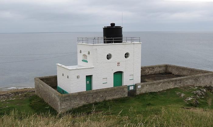
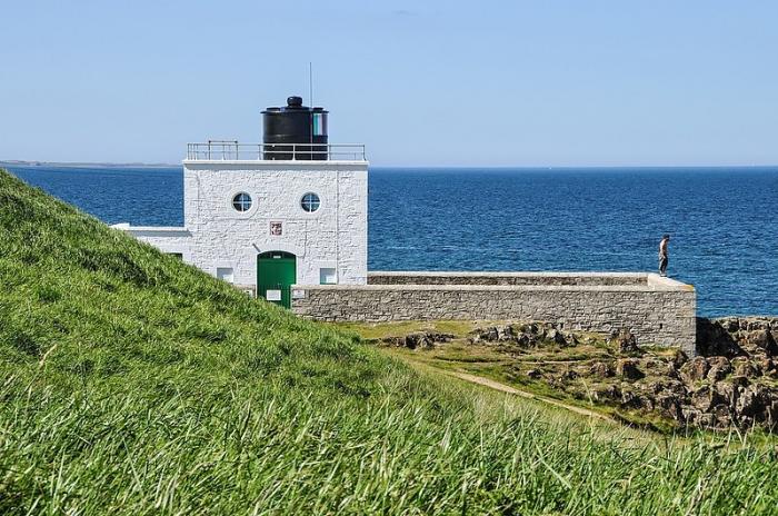
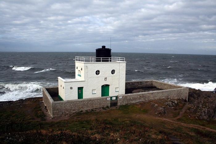
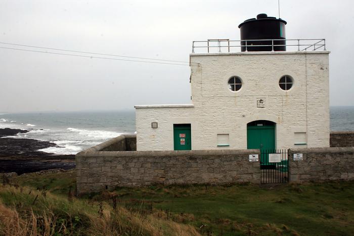
For over 80 years the small unmanned lighthouse at Bamburgh has given a guide to shipping in passage along the coast as well as to vessels in the waters around the Farne Islands. Bamburgh Lighthouse was built in 1910 and extensively modernized in 1975. A local attendant carries out routine maintenance at the station which is monitored from the Operations & Planning Centre at Harwich. It is the most Northerly land based lighthouse in England.
Height Of Tower 9 Metres
Height Of Light Above Mean High Water 12.5 Metres
Electrified 1964
The dangers of the North East coast have long since been noted, although no warnings or safety precautions were apparently employed until the late 18th century. The turbulence of the waters, however, can be matched by the turbulence of the area's history.
The Bamburgh area, and Bamburgh Castle in particular, has played an important role in English history since the occupation of the site by the Romans. Only 20 miles from the border Bamburgh Castle was once captured by the Scots and has also been fought over by the Danes and the Kings of Mercia and Northumbria.
By the late 18th century Bamburgh Castle had fallen into disrepair and became a charity school run by a Doctor Sharp, who also instituted various measures for the benefit of passing mariners. He set up an elementary lifeboat station in Bamburgh Village, operated a warning system of bells and guns from the Castle ramparts, and whilst gales persisted, employed 2 riders to patrol the shore and keep watch for ships in distress.
For over 80 years the small unmanned lighthouse at Bamburgh has given a guide to shipping in passage along the coast as well as to vessels in the waters around the Farne Islands. Bamburgh Lighthouse was built in 1910 and extensively modernized in 1975. A local attendant carries out routine maintenance at the station which is monitored from the Operations & Planning Centre at Harwich. It is the most Northerly land based lighthouse in England.
Nearby cities:
Coordinates: 55°36'59"N 1°43'26"W
- Souter Point Lighthouse 75 km
- Lees Scar Lighthouse 136 km
- Whitby Lower Harbour 144 km
- Wyre lighthouse 203 km
- Pladda Lighthouse 215 km
- Mull of Galloway Lighthouse 228 km
- Sanda Island Lighthouse nicknamed "the Ship" 247 km
- Liverpool bay Lightvessel Bar 254 km
- Bidston Observatories and Lighthouse 262 km
- Old lighthouses of Kaf-of-Maine 264 km
- Bamburgh castle golf club 0.9 km
- Budle Hall 2.1 km
- Brada Quarry 2.4 km
- Budle Bay 2.4 km
- Glororum Caravan Park 2.5 km
- Waren Caravan & Camping Park 2.6 km
- Inner Farne (National Trust) 4.3 km
- The Knivestone Wrecks 5.6 km
- Brownsman (High Tide line) 6.6 km
- The Christensen (Wreck) 8 km