Pointe Mouillee State Game Area
USA /
Michigan /
Estral Beach /
World
/ USA
/ Michigan
/ Estral Beach
World / United States / Ohio
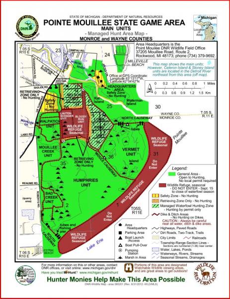
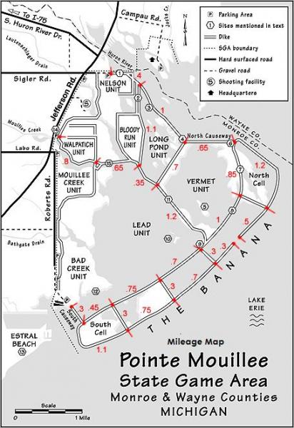
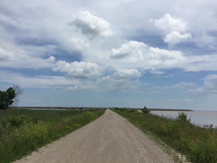
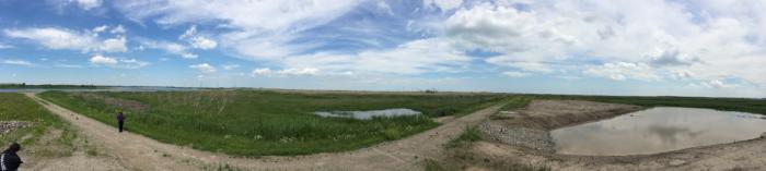
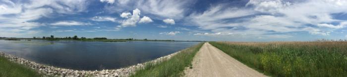
Pointe Mouillee (pronounced “Point Moo-yay”) is a spit of land that jets into Lake Erie near the mouth of the Huron River. Pointe Mouillee is one of the largest fresh water marsh restoration projects in the world—the result of a gigantic earth-moving/dike-building project. It consists of wetlands, diked marshes, and river bayous.
The wetland dikes make excellent hiking trails, although visitors should be aware that construction and maintenance traffic occurs throughout the year. Site maps are available at the area headquarters.
On the first weekend after Labor Day every year, the Pointe Mouillee Waterfowl Festival Committee puts on their annual waterfowl festival at the Pointe Mouillee State Game Area Headquarters. All funds generated by the festival go toward the restoration of the Pointe Mouillee Marsh.
www.michigandnr.com/publications/pdfs/wildlife/viewingg...
Nearby cities:
Coordinates: 42°1'3"N 83°11'53"W
- Lake Erie Country Club Subdivision 13 km
- The Meadows 15 km
- Comet, Ontario 17 km
- Belcreft Beach 17 km
- Gyori Farms Landscaping & Supplies 17 km
- Levergood Beach 17 km
- Boufsko Selo 17 km
- Seymour Beach 18 km
- Lypps Beach 18 km
- submerged rocks, be carefull 25 km
- StoneCo of Michigan - Newport Quarry 3.2 km
- WWJ Newsradio 950 radio tower array 3.4 km
- Big Al's Greens & Grille 6.6 km
- Enrico Fermi Nuclear Generating Station 7.9 km
- Meijer Distribution Center 10 km
- Stony Point, Michigan 11 km
- Woodland Beach, Michigan 13 km
- Detroit Beach, Michigan 14 km
- Holiday Beach Conservation Area 14 km
- Harrow Wind Farm 19 km