Narail District Town
Bangladesh /
Naral /
World
/ Bangladesh
/ Naral
/ Naral
dritte Verwaltungsebene, Stadtbezirk


Narail District (khulna division) with an area of 990.23 sq km, is bounded by magura district on the north, khulna district on the south, faridpur and gopalganj districts on the east, jessore district on the west. Annual average temperature maximum 37.1°C, minimum 11.2°C; annual rainfall 1467 mm. Main rivers are madhumati, nabaganga, bhairab, chitra and Kajla. There are many beels and baors most noted of which is Chachuri Beel.
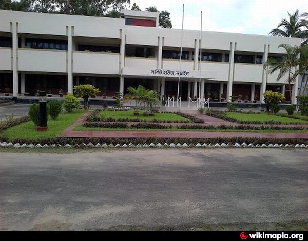
Narail (Town) stands on the bank of the Chitra river. It consists of 9 wards and 24 mahallas. The area of the town is 28.89 sq km. The town has a population of 36785; male 51.34%, female 48.66%; population density per sq km 1273. Literacy rate among the town people is 51.7%. The town has one rest house and one dakbungalow.
Administration: Narail district was established in 1984. It consists of 2 municipalities, 18 wards, 43 mahallas, 3 upazilas, 37 union parishads, 445 mouzas and 649 villages. The upazilas are narail sadar, kalia and lohagara. Municipalities are Narail Sadar and Kalia.
Archaeological heritage and relics: Mosque at Village Goalbathan (1654), Kadamtala Mosque, Ghazir Dargah at Naldi, Radha Govinda Mandir at Jorbangla (eighteenth century).
Historical events: Indigo Revolt was organised in this district during 1859-60; in 1946 Tebhaga movement was held in the district.
Populations 689021; male 54.22%, female 45.78%; Muslim 75.56%, Hindu 24.31% and others 0.13%.
Religious institutions Mosque 1156, temple 244, church 1.
Literacy and educational institutions: Average literacy 35.65%; male 42.23% and female 28.99%. Educational institutions: college 17, technical college 1, high school 94, junior high school 22, madrasa 85, maktab 160, government primary school 287, non-government primary school 171, art school 1, vocational school 1, technical school 3, blind school 1, kindergarten 2, community school 6, satellite school 19. Noted educational institutions: Narail Victoria Collegiate School (1856), Narail Government Victoria College (1886), Kalia Pilot High School (1865), Baraipara Primary School (1850), Babra Primary School (1895), Itna High School (1900), Singia Hatbalpur High School (1921), Banshgram Bishnupur High School (1932), Lohagara Pilot School.
Cultural organisations: Public library 6, club 160, cinema hall 4, women's organisation 104, theatre group 7, literary society 7, opera party 7, theatre group 12, playground 30.
Main occupations: Agriculture 47.55%, fishing 2.08%, agricultural labourer 18.02%, wage labourer 2.44%, industry 1.31%, business 10.92%, service 7.84%, transport 2.6% and others 7.24%.
Land use: Total cultivable land 78458 hectares; single crop 43.17%, double crop 44.25% and treble crop land 12.58%; land under irrigation 22.16%.
Land control: Among the peasants 27.45% are landless, 36.81% small, 14.77% intermediate and 20.97% rich.
Main crops Paddy, jute, wheat, oil seed, mustard, potato, sugarcane, kalai and khesari.
Fisheries, dairies, poultries Poultry 343, fishery 191, dairy 103, hatchery 68.
Communication facilities: Roads: pucca 243 km, semi pucca 74 km and mud road 1615 km; waterways 67 nautical mile.
Manufactories: Textile mill 1, biscuit factory 6, pen industry 1, saw mill 42, ice factory 18, rice and flour mill 45, lathe machine 6, welding 73 and printing press 4.
Cottage industries Include weaving, bamboo and cane work, wood work, goldsmith, blacksmith, potteries, tailoring etc.
Hats, bazars and fairs Hats and bazars are 84, fairs 19.
NGO activities: Operationally important NGOs are brac, asa, CARE, proshika, Comilla Proshika, grameen bank, Process, Palli Unnayan Prachesta, Uddipan, Gonoshahajjo Sangstha, Jagarani Chakra, ILD and Prataya.
Health centres: District sadar hospital 1, upazila health complex 2, maternity and child welfare centre 1, mission hospital 1, family welfare centre 33 , satellite clinic 7, private clinic 6, charitable hospital 4, veterinary hospital.
Nearby cities:
Koordinaten: 23°10'11"N 89°30'43"E
Array