Hattusa
Turkey /
Yozgat /
World
/ Turkey
/ Yozgat
/ Yozgat
World / Turkey / Çorum
archaeological site, UNESCO World Heritage Site, historic ruins


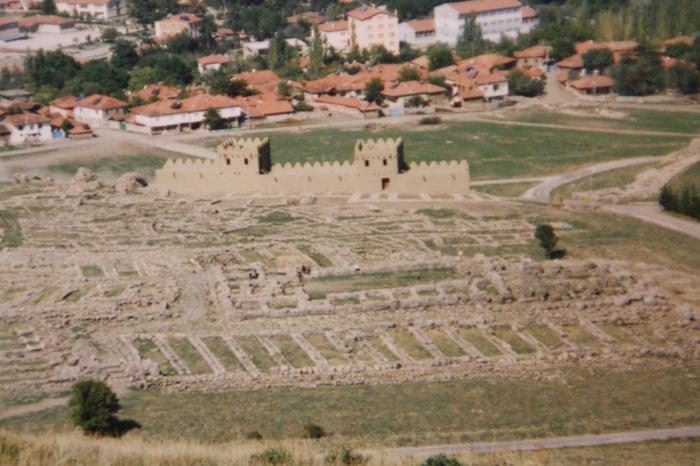
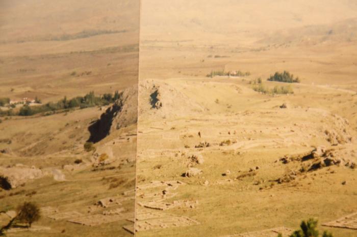
Hattusa (Ḫa-at-tu-ša; Ḫattuša) was the capital of the Hittite Empire. The site is located near the modern-day town and district center of Boğazkale ( 40°01′11″N, 34°36′55″E), formerly named Boğazköy, in Çorum Province in north-east Central Anatolia, Turkey, at a distance of 90 km from the province seat of Çorum. The region is set in a loop of the Kızıl River (Marashantiya in Hittite sources and Halys in Classical Antiquity) in central Anatolia, about 200 km (125 miles) east of Ankara.
Hittite: 𒌷𒄩𒀜𒌅𒊭
www.sciencealert.com/archaeologists-unearth-a-secret-lo...
Hittite: 𒌷𒄩𒀜𒌅𒊭
www.sciencealert.com/archaeologists-unearth-a-secret-lo...
Wikipedia article: http://en.wikipedia.org/wiki/Hattusha
Nearby cities:
Coordinates: 40°0'56"N 34°37'1"E
- Mount Athos (Agion Oros) 904 km
- Wadi Rum 1144 km
- Ennedi Massif 2798 km
- Manovo-Gounda St. Floris National Park 3643 km
- Garamba National Park 3975 km
- Okapi Wildlife Reserve 4232 km
- Ruwenzori Mountains National Park 4397 km
- Arli National Park 4562 km
- Pendjari National Park 4585 km
- Dja Faunal Reserve - UNESCO World Heritage Site 4644 km
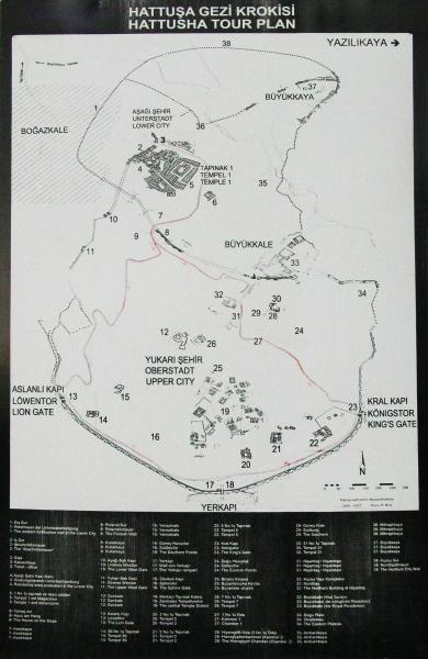
- Great Fortress 0.2 km
- Wall of the Upper City 0.2 km
- Lower City 0.6 km
- Temples District 0.6 km
- Büyükkaya 0.8 km
- Northern City 0.9 km
- Höyük 4.1 km
- Eskiyapar Höyük 21 km
- Yozgat (Province) 63 km
- Çorum (Province) 69 km