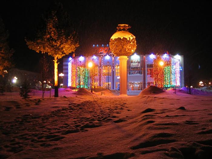
Nadym
Russia /
Jamalo-Nenets /
Nadym /
World
/ Russia
/ Jamalo-Nenets
/ Nadym
, 1 km from center (Надым)
World / Russia / Yamal-Nenets
city, district center


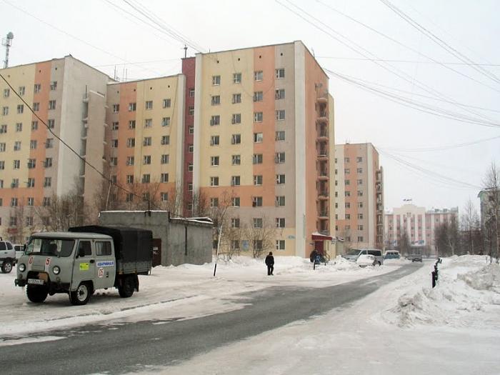
Nadym (Russian: Нады́м) is a town in Yamalo-Nenets Autonomous Okrug, Russia, located on the river Nadym. The population has fluctuated: 46,611 (2010 Census).
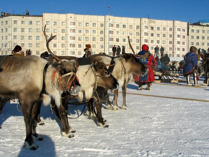
The first mention of the city's name appears at the end of the 16th century. The name "Nadym" appears on Russian maps from the end of the 17th century, and the river Nadym was noted in published form at the turn of the 17th and 18th centuries in the "Drawing Book of Siberia" by Russian geographer, cartographer and topographer, Semyon Remezov and sons, composed in 1699–1701. On the map of Tobolsk province of 1802, Nadym was already marked as having significant population. Today it's located 32 kilometers from the mouth of the river Nadym, referred to as Nadym mound. In 1929, a reindeer farm called "Nadym" was founded on the right bank of the river Nadym. However, in 1934 the farm was disbanded and turned into a factory. In the fall of 1967, it was chosen as the reference framework for the development of a regional gas-bearing deposit. Surrounded by numerous lakes, the village situated on an elevated dry place was chosen for a runway for aviation. Relatively small, 12 kilometers away from the river Nadym, for which it was named, by the 1950s–1960s, the village began to be called "New Nadym". In parallel to its accelerated pace of development, the gas company created Medvezhye gas field, with the intention of becoming a social and cultural center of the Tyumen North. In August 1971, Nadym held a groundbreaking ceremony for its first major building and on March 9, 1972, by decree of the Soviet First Secretary the industrial community Nadym was incorporated within the Nadymsky Municipal District as Nadym Urban Settlement.
The first mention of the city's name appears at the end of the 16th century. The name "Nadym" appears on Russian maps from the end of the 17th century, and the river Nadym was noted in published form at the turn of the 17th and 18th centuries in the "Drawing Book of Siberia" by Russian geographer, cartographer and topographer, Semyon Remezov and sons, composed in 1699–1701. On the map of Tobolsk province of 1802, Nadym was already marked as having significant population. Today it's located 32 kilometers from the mouth of the river Nadym, referred to as Nadym mound. In 1929, a reindeer farm called "Nadym" was founded on the right bank of the river Nadym. However, in 1934 the farm was disbanded and turned into a factory. In the fall of 1967, it was chosen as the reference framework for the development of a regional gas-bearing deposit. Surrounded by numerous lakes, the village situated on an elevated dry place was chosen for a runway for aviation. Relatively small, 12 kilometers away from the river Nadym, for which it was named, by the 1950s–1960s, the village began to be called "New Nadym". In parallel to its accelerated pace of development, the gas company created Medvezhye gas field, with the intention of becoming a social and cultural center of the Tyumen North. In August 1971, Nadym held a groundbreaking ceremony for its first major building and on March 9, 1972, by decree of the Soviet First Secretary the industrial community Nadym was incorporated within the Nadymsky Municipal District as Nadym Urban Settlement.
Wikipedia article: http://en.wikipedia.org/wiki/Nadym
Nearby cities:
Coordinates: 65°32'17"N 72°31'46"E
- Novy Urengoy 193 km
- Noyabrsk 290 km
- Surgut 466 km
- Pyt-Yakh 530 km
- Nizhnevartovsk 538 km
- Tobolsk 835 km
- Tara 957 km
- Seversk 1176 km
- Tomsk 1181 km
- Asino 1184 km
- ул. Зверева, 21 0.5 km
- ул. Зверева, 41 1 km
- Домашний очаг 1.2 km
- Солнышко 1.3 km
- Iceberg Hotel 1.4 km
- Средняя общеобразовательная школа №9 1.4 km
- ул. Зверева, 50 1.8 km
- ул. Рыжкова, 11 1.9 km
- ул. Рыжкова, 10 1.9 km
- микрорайон Олимпийский, 1 2 km
Comments