Green Lane Road (Leicester)

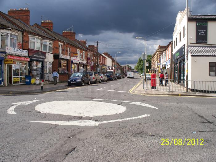


Situated in the Highfields area of Leicester, Green Lane Road is a busy road with moderate to high levels of traffic filtering through the area. It is consisted of mixed businesses such as fast food takeaways, alloy wheels suppliers, travel agents, greengrocers and beauty salons. There are also residential terraced houses situated along the road. Green Lane Road starts from a mini roundabout junction the other roads of Mere Road and Spinney Hill Road converges and finishes where the road of Wicklow Drive starts.
Green Lane Road, related objects
Nearby cities:
Coordinates: 52°38'11"N 1°5'48"W
- Humberstone Park 0.9 km
- Highfields 1 km
- Crown Hills Community College 1.1 km
- Leicester General Hospital 1.3 km
- Evington Park 1.8 km
- Evington 1.9 km
- The Leicestershire Golf Club 2.2 km
- City of Leicester College 2.5 km
- Shady Lane Arboretum 2.6 km
- Judgemeadow Community College 2.9 km
- Stanley Drive 1.6 km
- Headland Road 1.7 km
- B667 Evington Lane 1.9 km
- Thurmaston Lane 2 km
- Lower Keyham Lane 2 km
- Bedford Street North 2.1 km
- A47 Uppingham Road 2.1 km
- Netherhall Road 2.8 km
- B582 New Street 4.3 km
- Gartree Road 5.6 km