Satellite images updates list
| The contents of this article/page refers to a tool/feature which is not functioning properly at this moment in time. Please visit the forum for more information. |
Satellite images updates list is designed to simplify the work of updating Wikimapia object when our map provider (Google) updates the satellite images. To use this tool you should select satellite map type from the the top menu.
Contents |
What is the purpose of this tool?
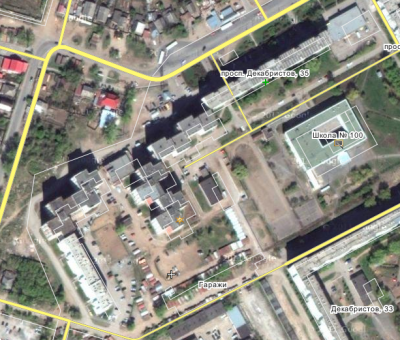
Every month Google updates their satellite imagery and as a result the outline positions of some Wikimapia objects become out of sync. This phenomena is also known to our users as map shifting.
Here is an example of an updated satellite image with out-of-sync Wikimapia data:
Wikimapia has a tool to correct re-match the object outlines and satellite photos. The map shift tool contains a list the most recent satellite images updates, or simply "map shifts".
Brief information
The satellite images updates list is accessible from the user tools page in the top menu or user profile page. You can use this direct link too.
You can select a map shift area, in any part of the world, in the list to view it:
If a map update has not affected Wikimapia's data (ie. the map has not shifted), you should click the "has no effect" button in the bottom toolbar.
If the map update has affect Wikimapia's data, you may edit the map shift by setting the shift points.
Please note that map shifts without any visible changes are not necessarily fine. Google first updates the satellite images in Google Earth, which provides the source data for Wikimapia's list, and then, often with a delay of weeks, the imagery in Google Maps. Therefore, we advise you to take extra care by checking the map using the higher zoom levels. If there is no evidence of changes such as "stitches" on the edges of the shift area, then it's probably the case and we advise you to wait until the images are updated.
Also you can create new map shift area by clicking "create new" button on the top of the list.
Creating/editing map shift area and options
Most of the areas in list are imported from Google by User:Moving_bot. In some cases these areas are not good for shifting:
- Area does not match updated satellite imagery exactly
- Area is very big and it is dangerously to move so many places and linear features at once
Also, there is no areas for already updated images.
In such cases you should click "create new" button on the top of the list to start area creation. It is similar to polygon creating, so it needs no additional description. But you should set shift options carefully:
- Check "shift places" if you want to shift places in created area.
- Check "shift roads/linear" if you want to shift roads and other linear features in created area.
- Specify approximate date of shift. All objects, created after this date will remain unchanged.
When you finished, save area and options and process to shift direction setting.
Setting/editing map shift direction
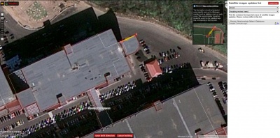
If you decide that the map shift needs to take place, you must click on the [no, the overlay needs shifting] button. There are two markers connected with arrow appeared on the map.
First marker should be located at some specific point on the Wikimapia overlay, such as building corner or roads cross.
Second marker should be placed at the point on satellite image where the first point should be.
Arrow should help you avoid any confusion.
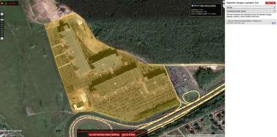
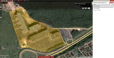
Left screenshot below shows how to properly set the markers on the map, to get the result as on the right screenshot after a successful shift:
Please note: you should mark shift as "fine" if there is no any objects in shifted area or it is better to move them manually.
Map shift processing
Every map shift needs some directions in order to be approved/declined. If map shift receives many "yes, it's fine" signs, it will be declined.
If users set many shift directions, Wikimapia calculates their average value and some statistics to decide automatically whether to shift objects and how.
Unlike the first two versions of this list, calling map shifting tool, there is no need now for advanced users to sign the shifts and for Wikimapia team to approve them.
All the approved shifts are being processed in background, so you can watch their status via filter in the map shifts list.


