Akraberg
Faroe Islands /
Suduroy /
Sumba /
World
/ Faroe Islands
/ Suduroy
/ Sumba
World / Faroe Islands / Suðuroyar
headland (geography)
Add category


Also known as Akrabyrgi.
commons.wikimedia.org/wiki/Akraberg
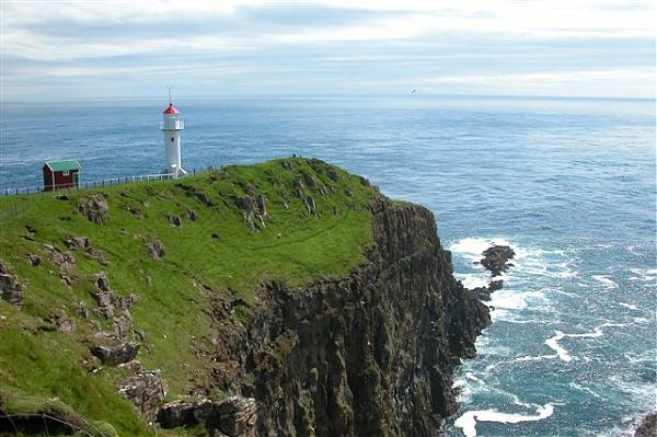
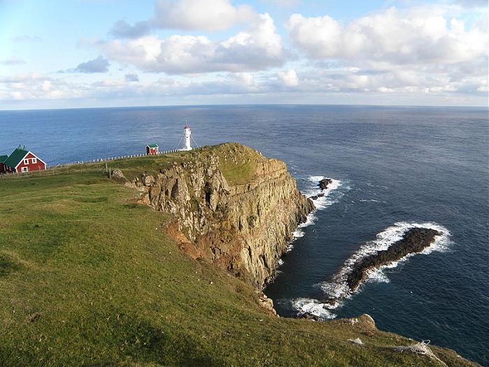
South of Sumba on the south-tip of the island is a place called Akraberg. In present time there is just a lighthouse in Akraberg but a Frisian colony was there from year 1040 until The Black Death killed all of them in 1350. The Frisians were heathen a long time after the rest of the Faroe Islands were christianised.
It is said that they partly lived by piracy and they are mentioned in several Faeroese legends.
faroeislands.dk/pages/SumbaIndex.htm
commons.wikimedia.org/wiki/Akraberg
South of Sumba on the south-tip of the island is a place called Akraberg. In present time there is just a lighthouse in Akraberg but a Frisian colony was there from year 1040 until The Black Death killed all of them in 1350. The Frisians were heathen a long time after the rest of the Faroe Islands were christianised.
It is said that they partly lived by piracy and they are mentioned in several Faeroese legends.
faroeislands.dk/pages/SumbaIndex.htm
Wikipedia article: http://en.wikipedia.org/wiki/Akraberg
Nearby cities:
Coordinates: 61°23'35"N 6°40'41"W
- Ness of Hillswick 297 km
- Strom Ness 318 km
- White Ness 320 km
- Am Parbh (Cape Wrath) 322 km
- Cape Wrath Firing Range 322 km
- Houss Ness 326 km
- Duncansby Head 366 km
- Cape Fontur 681 km
- Þórðarhöfði 811 km
- Hítarnes 872 km
- Sumbiar municipality 4.6 km
- Munkurin 5.7 km
- Vágsfjørður 10 km
- Suðuroy 17 km
- Trongisvágsfjørður 18 km
- Gluggarnir mountain 21 km
- Hvalbiarfjørður 27 km
- Suðuroyarfjørður 27 km
- Faroe Islands 58 km
- Rosemary Bank 304 km