2 nd. RING, THE WIDEST AVENUE IN BOLIVIA (Santa Cruz de la Sierra)
Bolivia /
Santa Cruz /
Santa Cruz de la Sierra /
Second Ring
World
/ Bolivia
/ Santa Cruz
/ Santa Cruz
World / Bolivia / Santa Cruz / Andrés Ibáñez
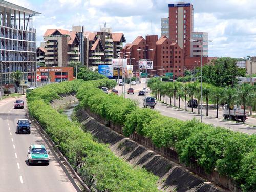
In Santa Cruz, there is aproximately one km from one ring to the next. The rings 1st to 4th are complete, but from the 5th to the rest, they are cut mainly because of the Pirai river, which at the northwest part of the city, is very close to the 4th ring.
Nearby cities:
Coordinates: 17°47'8"S 63°10'46"W
- VILLA PILLIN NEIGHBORHOOD ( UV.39 ) 4 km
- ALBO 5.2 km
- La Hacienda II 5.5 km
- Restaurant Mirador "La Casa del Camba del Urubo" 5.8 km
- Condominio Carabassi 6.5 km
- Cond. Acarai 6.8 km
- Comunidad "Los Batos" 7.3 km
- Santa Cruz de la Colina 7.3 km
- Entrada Cond. ICARAI 8.2 km
- Condominio Polo Country 14 km
- calle warnes 1.3 km
- La Salle School 1.9 km
- Base Aérea de El Trompillo 2.2 km
- paragua 2.4 km
- UV-29 2.4 km
- Runway 16/34 3.2 km
- barrio villa warnes 3.8 km
- Sugar Cane mill CIASA or "San Aurelio" 3.9 km
- Parque Industrial de Santa Cruz 5.6 km
- Sugar Cane plantation onwed by CIASA (San Aurelio) 7 km