Manpok Valley
Korea (North) /
Chagangdo /
Huichon /
World
/ Korea (North)
/ Chagangdo
/ Huichon
World / North Korea / P'yŏngan-bukto
valley, park


(만폭동/萬瀑洞)
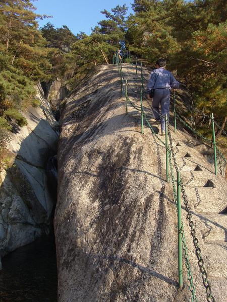
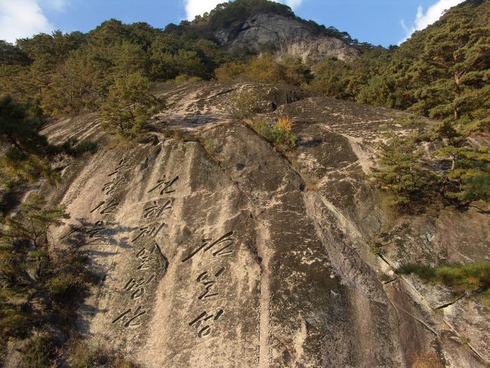
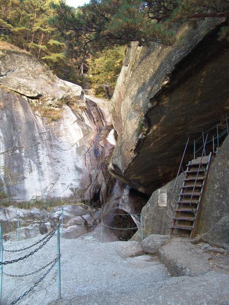
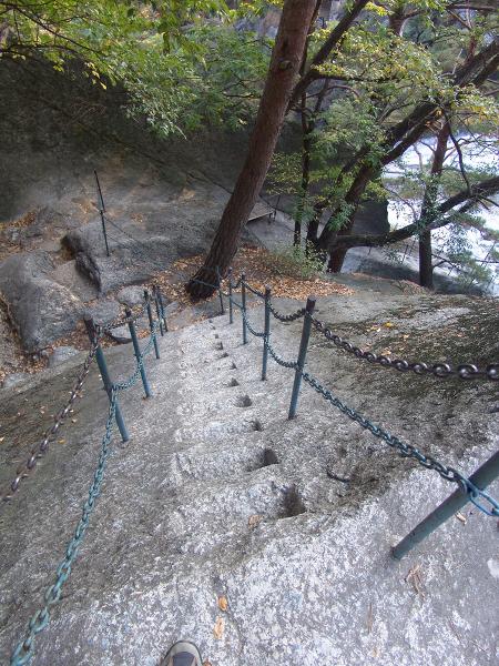
This lush valley is named "Valley of the Ten Thousand Falls" because of the many waterfalls which course down it.
A 6 Km round trip drenched in waterfalls: Sogok, Murung, Unson, Yusong, Pison and Kuchung.
Ladder steps carved in the rock and iron railings cables helps travelers walk the path.
This lush valley is named "Valley of the Ten Thousand Falls" because of the many waterfalls which course down it.
A 6 Km round trip drenched in waterfalls: Sogok, Murung, Unson, Yusong, Pison and Kuchung.
Ladder steps carved in the rock and iron railings cables helps travelers walk the path.
Nearby cities:
Coordinates: 40°0'41"N 126°16'30"E
- Takachiho Gorge 926 km
- Qi Zang Gou 2159 km
- Lam Tsuen Valley 2263 km
- Pallas Valley 2483 km
- Za Qu valley (Mekong valley) 2799 km
- Dzukou Valley 3394 km
- Ia Drang Valley 3452 km
- ChinDwin River, one of the major rivers of Myanmar. This river merges into AyeYarWady River. 3561 km
- Phobjikha Valley 3591 km
- Malango Valley 4397 km
- Myohyangsan Mountain Range 3.8 km
- Kim Il Sung Residence (DPRK Leadership Residence) 6.3 km
- Hyangsan-gun (Hyangsan County) 14 km
- Namchon-dong 17 km
- Solmoru-dong 17 km
- Hupyong 1-dong 18 km
- Hŭich'ŏn / Kalgol-dong Scud Missile Base 19 km
- Kujang-gun 20 km
- Nyongwon County 29 km
- Tongsin-gun (Tongsin County) 38 km