Pila
Philippines /
Southern Tagalog /
Pila /
World
/ Philippines
/ Southern Tagalog
/ Pila
World / Philippines / Laguna / Pila
town, municipality, third-level administrative division

Municipality of Pila, Province of Laguna
ZIP code: 4010
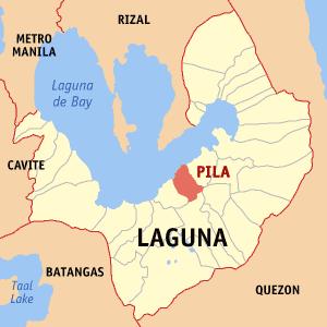
Pila is a municipality in the province of Laguna in the Philippines. It had a population of 46,534 people as registered in the 2010 Census. Pila has a total land area of 31.2 km².
Pila is administratively subdivided into 17 barangays:
-Aplaya
-Bagong Pook
-Bukal
-Bulilan Norte (Poblacion)
-Bulilan Sur (Poblacion)
-Concepcion
-Labuin
-Linga
-Masico
-Mojon
-Pansol
-Pinagbayanan
-San Antonio
-San Miguel
-Santa Clara Norte (Poblacion)
-Santa Clara Sur (Poblacion)
-Tubuan
ZIP code: 4010
Pila is a municipality in the province of Laguna in the Philippines. It had a population of 46,534 people as registered in the 2010 Census. Pila has a total land area of 31.2 km².
Pila is administratively subdivided into 17 barangays:
-Aplaya
-Bagong Pook
-Bukal
-Bulilan Norte (Poblacion)
-Bulilan Sur (Poblacion)
-Concepcion
-Labuin
-Linga
-Masico
-Mojon
-Pansol
-Pinagbayanan
-San Antonio
-San Miguel
-Santa Clara Norte (Poblacion)
-Santa Clara Sur (Poblacion)
-Tubuan
Wikipedia article: http://en.wikipedia.org/wiki/Pila,_Laguna
Nearby cities:
Coordinates: 14°14'0"N 121°22'17"E
- Mauban 33 km
- Tagkawayan 108 km
- General Nakar 110 km
- Labo, Camarines Norte 116 km
- Doña Remedios Trinidad 120 km
- Dipaculao 217 km
- Dupax del Sur 236 km
- Nagtipunan 237 km
- Casiguran 247 km
- Maddela 255 km
- Victoria Town Proper 4.7 km
- NHA DAYAP CALAUAN, LAGUNA 7.5 km
- Laguna 7.7 km
- hanggan 9 km
- Bay Town Proper 11 km
- san nicolas 11 km
- Dila 11 km
- San Antonio 11 km
- Puypuy 12 km
- Laguna de Bay 18 km
Comments