Aktanysh
Russia /
Tatarstan /
Aktanysh /
World
/ Russia
/ Tatarstan
/ Aktanysh
, 3 km from center (Актаныш)
World / Russia / Tatarstan
village, district center
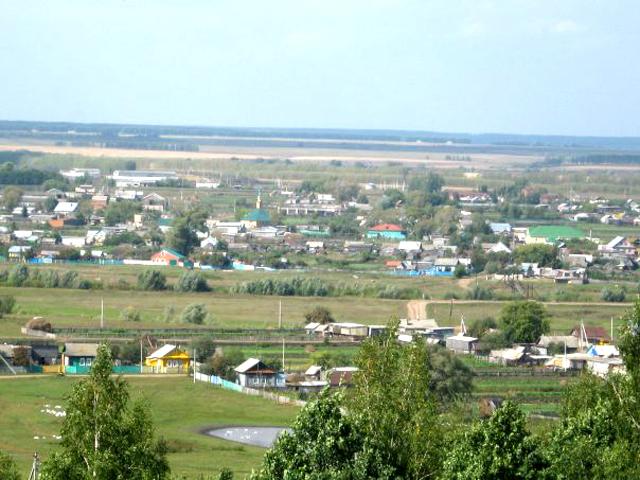
Aktanysh (Russian: Актаны́ш; Tatar: Актаныш; Bashkir: Аҡтаныш), historically known as Lower Aktanyshbash (Russian: Нижний Актанышбаш; Bashkir: Түбәнге Аҡтанышбаш) is a rural locality (a selo) and the administrative center of Aktanyshsky District of the Republic of Tatarstan, Russia. The population is less than 10,000, though it has steadily increased in recent decades; 8,923 (2010 Census). The village is situated in the lower reaches of the Belaya (Ağiðel) river, in the easternmost part of Tatarstan, less than 6 km (3.7 mi) from the border with Bashkortostan. Aktanysh lies about 300 km (190 mi) east of Kazan and 165 km (103 mi) northwest of Ufa as the crow flies.
Aktanysh was settled by Bashkirs of the Yabalakovskaya tyuba of the Kyrgyz volost in the period prior to Bashkir integration into the Russian State. The earliest known record of the settlement dates from 1715. Until 1920, the village was the center of Aktanyshsky Volost of the Menzelinsky Uyezd of Ufa Governorate. Aktanysh was included in the Tatar Autonomous Soviet Socialist Republic as part of the Menzelinsky canton. Since 1930 it has served as the center of the Aktanyshsky District, excepting the period during 1963 to 11 January 1965 when it was part of the Menzelinsky District. In the period from 1988 to 1991, Aktanysh had the status of an urban-type settlement.
Aktanysh was settled by Bashkirs of the Yabalakovskaya tyuba of the Kyrgyz volost in the period prior to Bashkir integration into the Russian State. The earliest known record of the settlement dates from 1715. Until 1920, the village was the center of Aktanyshsky Volost of the Menzelinsky Uyezd of Ufa Governorate. Aktanysh was included in the Tatar Autonomous Soviet Socialist Republic as part of the Menzelinsky canton. Since 1930 it has served as the center of the Aktanyshsky District, excepting the period during 1963 to 11 January 1965 when it was part of the Menzelinsky District. In the period from 1988 to 1991, Aktanysh had the status of an urban-type settlement.
Wikipedia article: http://en.wikipedia.org/wiki/Aktanysh
Nearby cities:
Coordinates: 55°42'54"N 54°3'43"E
- Verkhnecherekulevo 30 km
- Nizhneyarkeyevo 30 km
- Verkhneyarkeyevo 30 km
- Ismailovo 38 km
- Angasyak 45 km
- Ivanayevo 53 km
- Bakaly 60 km
- Starokuruchevo 63 km
- Starokalmashevo 80 km
- Kalmashbashevo 84 km
- Tank 6 km
- Tank 6 km
- Tank 6 km
- Tank 6 km
- Tank 6 km
- Baysarovo crossroads 28 km
- Bridge across the Aushta river 28 km
- Bridge across the Syun river 28 km
- Bridge across the Terpelya river 32 km
- Poisevo crossroads 40 km