Duhok City
Iraq /
Dahuk /
World
/ Iraq
/ Dahuk
/ Dahuk
, 4 km from center (دهوك)
World / Iraq / Dihok
city, capital city of state/province/region
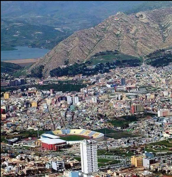
Dohuk (also spelled Duhok, Dehok or Dahok, Kurdish: دهۆك, Arabic: دهوك, Syriac: ܢܘܗܕܪܐ, Nohadra) is a city in South Kurdistan and is the capital of Dahuk Governorate. It has about 500,000 inhabitants, mostly consisting of Kurds. Assyrians form a minority. According to some sources, the name "Dohuk" comes from Kurmanji Kurdish meaning "small village".
There is a small Armenian comunity of nearly 226 people living in the town.
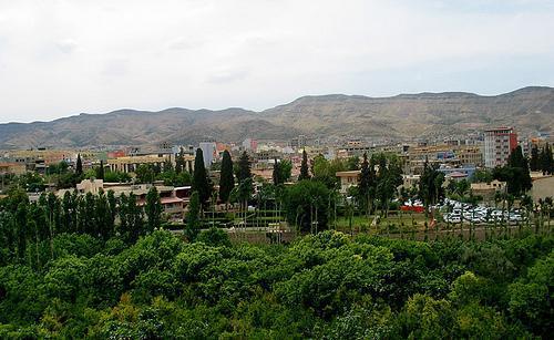
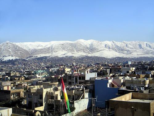
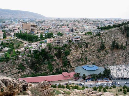
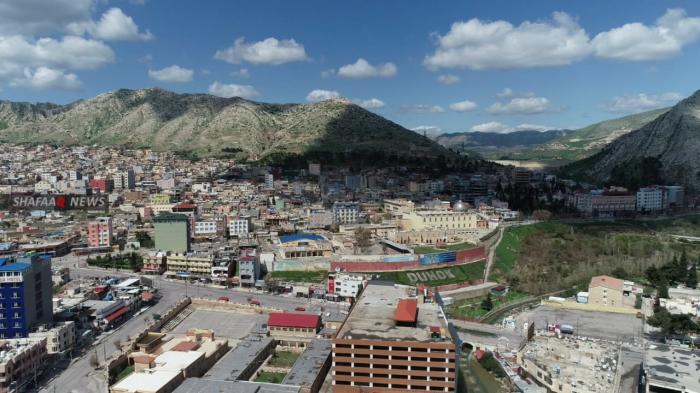
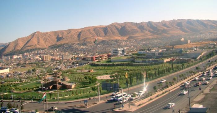
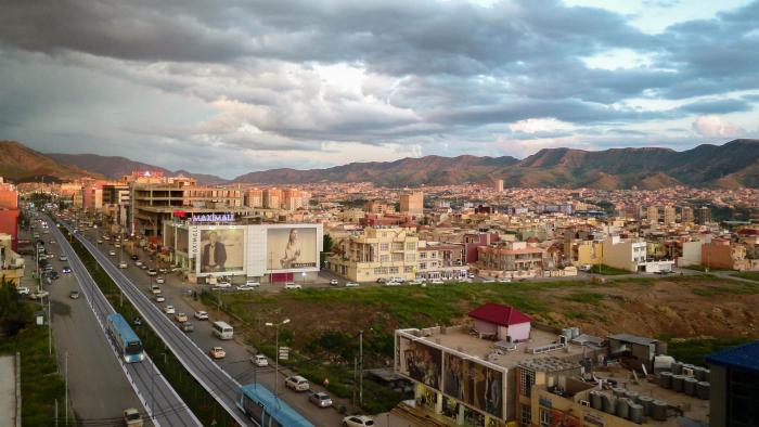
The city is encircled by mountains along the Tigris river. Dohuk has a growing tourist industry. Its population has increased rapidly since the 1990s, as the rural population moved to the cities.
Throughout history to the present time, Duhok has acquired a strategic position historically and geographically. Between the 25th and 22nd century BC, it changed hands between the Akkadians-Assyrians, Hurrians, Gutians and Hattians, before becoming an integral part of Assyria from the mid 21st century BC until the dissolution of Assyria (then known as Athura/Assuristan) in the 7th century AD. During the Assyrian period the town was named Nohadra (and also Bit Nuhadra or Naarda), where, during the Parthian-Sassanid rule in Assyria it became an eparchy within the Assyrian Church of the East metropolitanate of Ḥadyab (Arbil).
The city became prominent again in 1236, when Hasan Beg Saifadin joined the Kurdish Badinan principality. In 1842, the principality was dissolved by the Ottomans and connected to the city of Mosul.
In 1898 there were according to a report eleven small and private schools in the city, two Assyrian Christian and two Jewish schools. In 1920 there were in all of Iraq only five primary schools that were accessible for girls, and one of them was in Dohuk.
From 22 to 24 September 2005 Dohuk held a cultural festival that was for the first time in Dohuk to which Kurdish writers from all countries were invited.
In 2014, the city was used to house many Yazidi and Assyrian refugees who were escaping the advance of the Islamic State.
There is a small Armenian comunity of nearly 226 people living in the town.
The city is encircled by mountains along the Tigris river. Dohuk has a growing tourist industry. Its population has increased rapidly since the 1990s, as the rural population moved to the cities.
Throughout history to the present time, Duhok has acquired a strategic position historically and geographically. Between the 25th and 22nd century BC, it changed hands between the Akkadians-Assyrians, Hurrians, Gutians and Hattians, before becoming an integral part of Assyria from the mid 21st century BC until the dissolution of Assyria (then known as Athura/Assuristan) in the 7th century AD. During the Assyrian period the town was named Nohadra (and also Bit Nuhadra or Naarda), where, during the Parthian-Sassanid rule in Assyria it became an eparchy within the Assyrian Church of the East metropolitanate of Ḥadyab (Arbil).
The city became prominent again in 1236, when Hasan Beg Saifadin joined the Kurdish Badinan principality. In 1842, the principality was dissolved by the Ottomans and connected to the city of Mosul.
In 1898 there were according to a report eleven small and private schools in the city, two Assyrian Christian and two Jewish schools. In 1920 there were in all of Iraq only five primary schools that were accessible for girls, and one of them was in Dohuk.
From 22 to 24 September 2005 Dohuk held a cultural festival that was for the first time in Dohuk to which Kurdish writers from all countries were invited.
In 2014, the city was used to house many Yazidi and Assyrian refugees who were escaping the advance of the Islamic State.
Wikipedia article: http://en.wikipedia.org/wiki/Dahuk,_Iraq
Nearby cities:
Coordinates: 36°51'50"N 42°59'13"E
- Van Metropolitan Municipality 196 km
- Batman 210 km
- Khoy 256 km
- Diyarbakır Metropolitan Municipality 289 km
- Yerevan 395 km
- Bayburt ( Baberd ) 457 km
- Erzincan 458 km
- Köse 479 km
- Kelkit 484 km
- Ortahisar (District) 546 km
- Nohedra 0.4 km
- Gre Base 0.5 km
- Old city of Duhok / Modren Bazar 1 km
- Şoreş 1 km
- Shehida 1.1 km
- Park 1.1 km
- Ashti 1.3 km
- K.R.O 1.9 km
- Duhok Dam 3.6 km
- Dohuk Province 32 km
Comments