Banks Lake
| reservoir, irrigation
USA /
Washington /
Electric City /
World
/ USA
/ Washington
/ Electric City
World / United States / Washington
lake, reservoir, irrigation
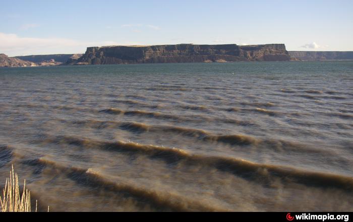
Banks Lake is a 27 mile long reservoir in central Washington in the United States.
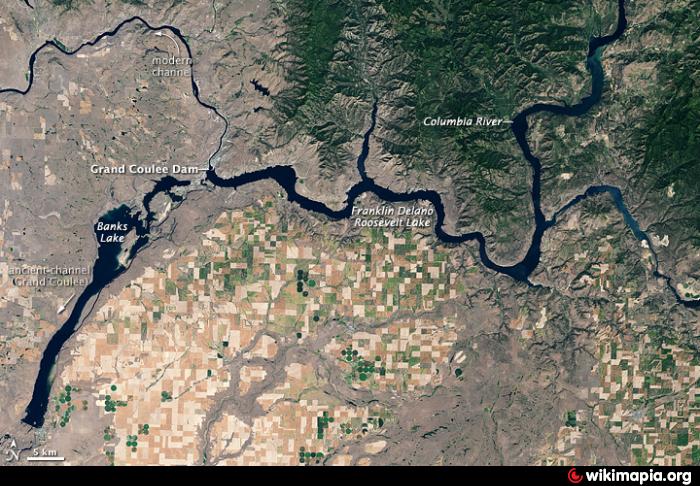
Part of the Columbia Basin Project, Banks Lake occupies the northern portion of the Grand Coulee, a formerly dry coulee near the Columbia River, formed by the Missoula Floods during the Pleistocene epoch. Grand Coulee Dam, built by the United States Bureau of Reclamation on the Columbia River created Franklin D. Roosevelt Lake, the reservoir on the river behind the dam. The surface of Lake Roosevelt is several hundred feet above the original Columbia River, making it easier to pump water 280 feet up and out of the river's canyon into the adjacent Grand Coulee. Two low earth-fill dams, Dry Falls Dam and North Dam, keep the water in the Grand Coulee, thus creating the reservoir named Banks Lake. It is named after Frank A. Banks, the construction supervisor at Grand Coulee Dam.
At the north end of Banks Lake the city of Grand Coulee and the town of Electric City are located. Steamboat Rock State Park is in the north-central portion. The town of Coulee City is at the south end of the lake. From the south end, the water stored in Banks Lake is distributed over a large region for irrigation of the Columbia Basin Project.
Man-made lake acting as a reservoir for large-scale irrigation in eastern Washington (Columbia Project). Water impounded by Grand Coulee Dam is pumped uphill in huge tubes to a feeder canal, which empties into the lake. The other end of the lake is at an earthen dam at the town of Coulee City, just above Dry Falls.
Wikipedia article: http://en.wikipedia.org/wiki/Banks_Lake
Nearby cities:
Coordinates: 47°47'6"N 119°9'40"W
- Billy Clapp Lake 33 km
- Rufus Woods Lake 55 km
- Omak Lake 63 km
- Moses Lake 65 km
- Lake Pateros 66 km
- Lake Wanapum 86 km
- Lake Entiat 87 km
- Rock Island Pool 92 km
- Lake Chelan 128 km
- Franklin D. Roosevelt Lake 174 km
- Bridge 7.4 km
- Culvert 9 km
- Steamboat Rock State Park 9 km
- Culvert 10 km
- Former highway disappears in Banks Lake 10 km
- Northrup Boat Ramp & Parking 11 km