Kibungan
Philippines /
Cordillera /
Kibungan /
World
/ Philippines
/ Cordillera
/ Kibungan
World / Philippines / Benguet / Kibungan
town, municipality, third-level administrative division

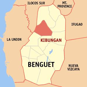

Municipality of Kibungan, Province of Benguet
ZIP Code: 2611
Kibungan is a municipality in the landlocked province of Benguet in the Philippines. It had a population of 16,850 people as registered in the 2010 Census.
The municipality is located 62 kilometers north of Baguio City.
Kibungan is well known in the province of Benguet as the town with unique grand mountains often mistaken to resemble those of the Switzerland mountains. Deep ravines and cliffs separate and isolate many sitios of some barangays. Although some plateaus, hills and small valleys can be seen in the locality, Kibungan is dominantly mountainous.
The municipality is within a cool highland mountainous zone with elevations at more than 2500 meters above sea level.During its coolest months of December - January, Barangay Madaymen experiences chilling temperature of 0 degrees Celsius causing the famous Frost of Madaymen.
Kibungan is politically subdivided into 7 barangays:
-Badeo
-Lubo
-Madaymen
-Palina
-Poblacion
-Sagpat
-Tacadang
Wikipedia article: http://en.wikipedia.org/wiki/Kibungan,_Benguet
Nearby cities:
Coordinates: 16°42'50"N 120°41'21"E
- Echague 96 km
- Conner 141 km
- Tineg 141 km
- San Mariano 141 km
- Dinapigue 146 km
- Nueva Era 166 km
- Peñablanca 168 km
- Kabugao 170 km
- Lal-lo 193 km
- Calanasan 205 km
- Mount Bakoko 4.8 km
- Mount Tagpaya 5.3 km
- Mount Tagpew 5.7 km
- Mount Osdung 7.9 km
- Mount Oten 9 km
- Tawang 9 km
- Bakun Central 9 km
- Sitio Dalipey 10 km
- Mount Binmaca 10 km
- Ilocos Sur 64 km
Comments