County Mayo (Contae Mhaigh Eo)
Ireland /
Mayo /
Castlebar /
World
/ Ireland
/ Mayo
/ Castlebar
World / Republic of Ireland
county, second-level administrative division, draw only border

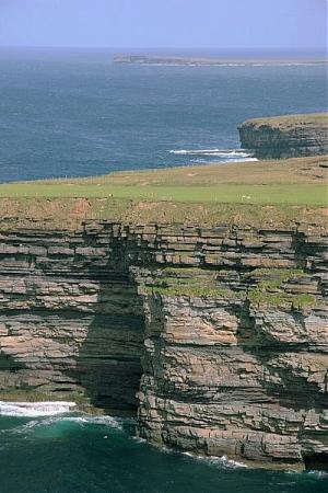

County Mayo (Irish: Contae Mhaigh Eo, meaning "Plain of the yew trees") is a county in Ireland. In the West of Ireland, in the province of Connacht, it is named after the village of Mayo, now generally known as Mayo Abbey. Mayo County Council is the local authority. The population was 130,507 at the 2016 census.The boundaries of the county, which was formed in 1585, reflect the Mac William Íochtar lordship at that time.
Wikipedia article: http://en.wikipedia.org/wiki/County_Mayo
Nearby cities:
Coordinates: 53°54'38"N 9°25'17"W
- Argyll & Bute Council 346 km
- Galiza 1131 km
- Castile and León 1204 km
- Navarre 1284 km
- Aragon 1332 km
- Castile-La Mancha 1436 km
- Extremadura 1504 km
- Valencian Community 1575 km
- Andalusia 1696 km
- Tessalit Cercle (w.p.) 3622 km
- Beltra Lough / Loch Bhéal Trá 1.7 km
- Croaghmoyle (Cruach Mhaol - 428m) 3.3 km
- Islandeady Lough 9 km
- Castlebar Lough 10 km
- Roadstone Castlebar 11 km
- Castlebar (Caisleán an Bharraigh) 11 km
- Derryhick Lake 14 km
- Lough Cullin / Loch Cuilinn 17 km
- Carrowmore Lough 18 km
- Walshpool Lough 19 km