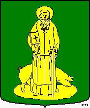
Sint Anthonis (municipality)
Netherlands /
Noord-Brabant /
Sint Anthonis /
World
/ Netherlands
/ Noord-Brabant
/ Sint Anthonis
World / Netherlands / Noord-Brabant
municipality, second-level administrative division, draw only border
Sint Anthonis (221 Sint Antonis.ogg pronunciation (help·info)) is a municipality and a town in the southern Netherlands. The locals refer to the town as Sint Tunnis. An inhabitant is called a "Sintunnisenaar".
As of January 1st, 2007 the town has 4.236 inhabitants (2.077 female and 2.103 male).
As of January 1st, 2007 the town has 4.236 inhabitants (2.077 female and 2.103 male).
Wikipedia article: http://en.wikipedia.org/wiki/Sint_Anthonis
Nearby cities:
Coordinates: 51°37'17"N 5°50'55"E
- Bronckhorst 60 km
- Ede (municipality) 63 km
- Lochem (municipality) 73 km
- Essen 73 km
- Berkelland 73 km
- Apeldoorn (municipality) 74 km
- Barneveld (municipality) 74 km
- Hof van Twente 87 km
- Cologne 88 km
- Dinkelland 113 km
- Recreatiepark - Camping "de Bergen" 3.6 km
- Rijkevoort Interchange 6.3 km
- MSD Animal Health NL (former Intervet) 6.6 km
- Electrical sub-station 7 km
- Nabuurs transport 8.2 km
- Former railroad crossing Maaslijn - Duits Lijntje 8.5 km
- Electrical sub-station 11 km
- Cuijk burial site 11 km
- Limburg 40 km
- North Brabant 52 km