Madeira Island
Portugal /
Madeira /
Funchal /
World
/ Portugal
/ Madeira
/ Funchal
World / Portugal / Madeira / Câmara de Lobos
island
Add category
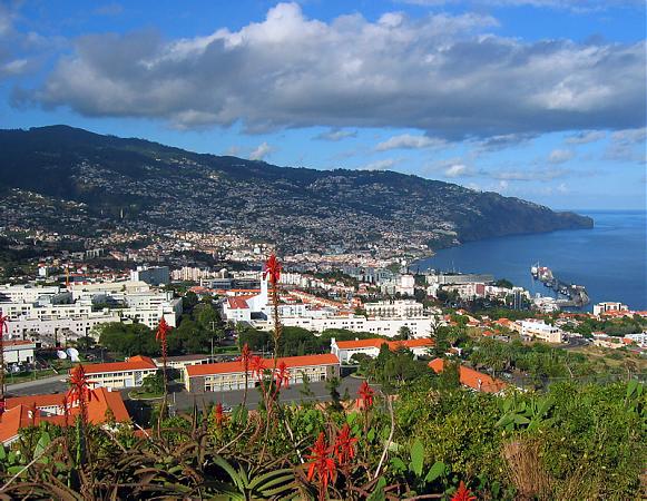

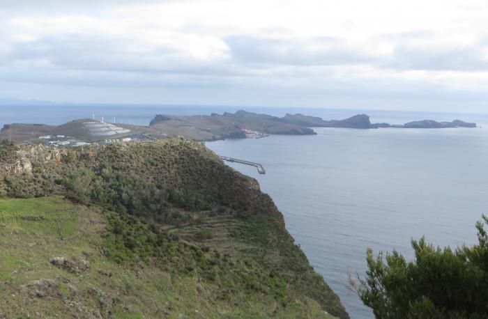


Madeira Island represents 93% of the archipelago's area, with 90% of the landmass above 500 m. It is the largest island of the group with an area of 741 km2 (286 sq mi), a length of 57 km (35 mi) (from Ponte de São Lourenço to Ponte do Pargo), while approximately 22 km (14 mi) at its widest point (from Ponte da Cruz to Ponte São Jorge), with a coastline of 150 km (90 mi). It has a mountain ridge that extends along the centre of the island, reaching 1,862 meters (6,109 feet) at its highest point (Pico Ruivo), while much lower (below 200 meters) along its eastern extent. The primitive volcanic foci responsible for the central mountainous area, consisted of the peaks: Ruivo (1862 meters), Torres (1851 meters), Arieiro (1818 meters), Cidrão (1802 meters), Cedro (1759 meters), Casado (1725 meters), Grande (1657 meters), Ferreiro (1582 meters). At the end of this eruptive phase, an island circled by reefs was formed, its marine vestiges are evident in a calcareous layer in the area of Lameiros, in São Vicente (which was later explored for calcium oxide production). Sea cliffs, such as Cabo Girão, valleys and ravines extend from this central spine, making the interior generally inaccessible. Daily life has concentrated in the many villages at the mouths of the ravines, through which the heavy rains of autumn and winter usually travel to the sea. A long, narrow, and comparatively low rocky promontory forms (Paul da Serra) the western extremity of the island, on which lies a tract of calcareous sand known (1300–1500 meters). It is a fossil bed, that contains shells and numerous bodies resembling the roots of trees, probably produced by infiltration.
Wikipedia article: https://en.wikipedia.org/wiki/Madeira_Island#Madeira_Island
Nearby cities:
Coordinates: 32°45'6"N 16°57'42"W
- Porto Santo Island 66 km
- La Palma 445 km
- Tenerife 463 km
- Lanzarote 489 km
- Fuerteventura 503 km
- La Graciosa Island 504 km
- La Gomera 506 km
- Gran Canaria 520 km
- El Hierro 558 km
- Ilha de Tavira / Tavira Island 973 km
- Pico Ruivo 1.9 km
- Pico das Torres (1853 m) 2.3 km
- Hilberto Tuazon Farm 3.1 km
- Encumeada 5.4 km
- Riberio Frio 7.3 km
- Santana, Madeira 8.1 km
- Santana Part Tematico 9 km
- Baia, Fajã da Areia 10 km
- baia dos juncos 10 km
- estadio 10 km
Comments