Rhodes Air Base
| military airbase, military, map location with missing/unclear/blurred data
Greece /
Dodekanisos /
Maritsa /
World
/ Greece
/ Dodekanisos
/ Maritsa
, 3 km from center (Μαριτσά)
World / Turkey / Mugla
military airbase, military, map location with missing/unclear/blurred data
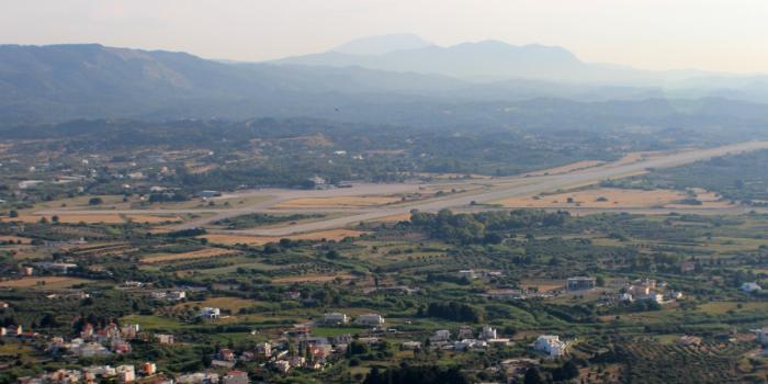
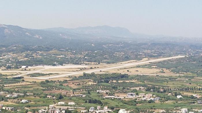
Rhodes Maritsa Airport (Greek: Αερολιμένας Ρόδου - Μαριτσών) (IATA: LGRD) is a military air base located on the island of Rhodes in Greece. The airport is located 14 km south west of the capital city of Rhodes, near the village of Maritsa, and 3 km south of the new Rhodes International Airport.
Airport type: Military
Elevation: 204 ft / 62 m
Runways:
- 08/26 (Direction), 2,400 m / 7,874 ft (Length), Asphalt (Surface)
- 14/32 (Direction), 1,200 m / 3,937 ft (Length), Asphalt (Surface)
Airport type: Military
Elevation: 204 ft / 62 m
Runways:
- 08/26 (Direction), 2,400 m / 7,874 ft (Length), Asphalt (Surface)
- 14/32 (Direction), 1,200 m / 3,937 ft (Length), Asphalt (Surface)
Wikipedia article: https://en.wikipedia.org/wiki/Rhodes_Air_Base
Nearby cities:
Coordinates: 36°23'2"N 28°6'33"E
- Sphinx International Airport 740 km
- Uthman Airbase 790 km
- Al Khadim Air Base 800 km
- Sdot Micha Airbase 804 km
- Ovda IAF Airbase & International Airport 952 km
- Ain al-Asad/al-Qadissiyyah Airfield 1330 km
- Wadi Al Khirr Airbase 1487 km
- al-Watya Air Base 1552 km
- Al salman military airport (disused) 1646 km
- King Khalid Air Base 2469 km
- Runway 08/26 0.1 km
- Runway 14/32 0.8 km
- Apron 2.8 km
- Rhodes International Airport "Diagoras" 3.1 km
- Runway 07/25 3.2 km
- Taxiway 3.4 km
- 211 Motor infantry battalion 6.3 km
- Butterfly Valley (Petaloudes) 6.9 km
- Power Plant 8.3 km
- Rhodes 27 km
Comments