Mount Sannine
Lebanon /
al-Biqaa /
Zahhlah /
World
/ Lebanon
/ al-Biqaa
/ Zahhlah
, 11 km from center (زحلة)
World / Lebanon / Mount Lebanon
mountain, invisible
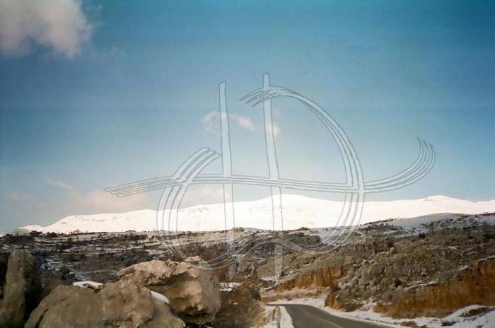
Mount Sannine, with its snow-capped summit towering above Beirut, is arguably Lebanon best-known mountain, and at 2.628m, one of its highest. Due to its limestone nature, it forms one of Lebanon's principal aquifers, and is the site of dozens of springs feeding some of the country's main rivers (Nahr el Kalb, Nahr Beirut, Nahr el Berdawni...) Due to the abundance of water, the mountain's Western slopes, partly covered with pine groves, are one of Lebanon's most densely populated areas.
Wikipedia article: http://en.wikipedia.org/wiki/Mount_Sannine
Nearby cities:
Coordinates: 33°57'43"N 35°53'30"E
- Kfardebian 17 km
- Mount Barouk 26 km
- Mnaitra mountain range 29 km
- Dahr el Qadib 39 km
- Fam el Mizab 39 km
- Mount Snir 46 km
- Jabal el Makmel 48 km
- Mount Hermon/Jebel al-Shaykh 53 km
- Jabal Rihane Biosphere Reserve 59 km
- al-Qalamoun Mountains/Northern Anti-Lebanon 62 km
- Mzaar / Ouyoun es Siman ski resort 4.3 km
- (Warde Slopes - Rose Slopes) PARKING 4.9 km
- Mountain lake 5.1 km
- Slouqi municipality 6.6 km
- Bednayel municipality 7.3 km
- Shmestar municipality 10 km
- Taraya municipality 11 km
- Keserwan District 12 km
- Matn District 17 km
- Mount Lebanon Governorate 34 km