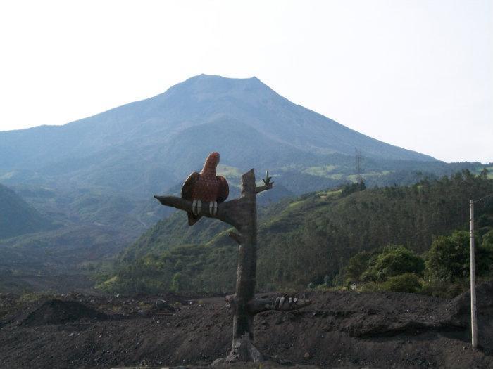
Tungurahua Volcano
Ecuador /
Tungurahua /
Bacos /
World
/ Ecuador
/ Tungurahua
/ Bacos
World / Ecuador / Tungurahua / Baños
mountain, park, volcano

Elevation: 5023 meters (16,480 feet)
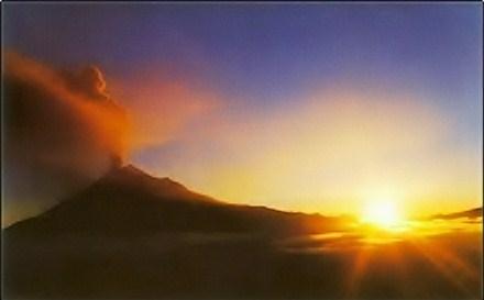
Tungurahua, (pronounced /tʊŋɡʊˈrɑːwə/), (Quichua tunguri (throat), rahua (fire): "Throat of Fire") is an active stratovolcano located in the Cordillera Central of Ecuador.
See the drifting plume in the satellite image. Beautiful spectacle
peakbagger.com/peak.aspx?pid=8413
Tungurahua, (pronounced /tʊŋɡʊˈrɑːwə/), (Quichua tunguri (throat), rahua (fire): "Throat of Fire") is an active stratovolcano located in the Cordillera Central of Ecuador.
See the drifting plume in the satellite image. Beautiful spectacle
peakbagger.com/peak.aspx?pid=8413
Wikipedia article: http://en.wikipedia.org/wiki/Tungurahua
Nearby cities:
Coordinates: 1°28'13"S 78°26'43"W
- San Salvador (Santiago, James) Island 1391 km
- Khapia Volcano (extinct) 1932 km
- Payun Matru Volcano 3993 km
- Cochiquito Volcanic Group 4032 km
- Puyehue-Cordón Caulle 4376 km
- Pali-Aike Volcanic Field 5661 km
- Volcano Bridgeman 6979 km
- Montagu Island 7775 km
- Volkano Hudson 8227 km
- Mount Takahe 3,460 metres (11,352 feet) 8585 km
- The Swing at the End of the World 6.2 km
- Mt. Igualata 22 km
- Runway 05/23 31 km
- Aeropuerto de Chimborazo 31 km
- Instituto de Salud Integral de La Mujer 32 km
- EDS SENSACION 32 km
- Football field 32 km
- Pond 32 km
- Estadio Olímpico de Riobamba 32 km
- EDS BRITO 33 km