Rudchester Roman Fort , Hadrian's Wall
| Roman Empire, Hadrian's Wall, interesting place, UNESCO World Heritage Site, scheduled ancient monument
United Kingdom /
England /
Wylam /
World
/ United Kingdom
/ England
/ Wylam
World / United Kingdom / England
Roman Empire, Hadrian's Wall, interesting place, UNESCO World Heritage Site, scheduled ancient monument
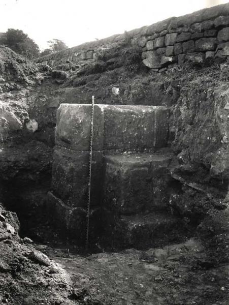
The fort covers an area of about 4½ acres (c.1.8 ha), measuring 515 feet north-south by 385 feet east-west (157 x 117 m), and has a standard 'playing-card' outline. The praetentura of the fort is positioned forward of the line of the Wall, with both ends of the via principalis opening out onto the north side. Excavation has outlined a tumultuous history for the fort; towards the end of the second century it was burned to the ground and was rebuilt shortly afterwards only to be abandoned a century later, the defences were later restored (c.AD370) and the fort reoccupied until the end of Roman rule in Britain at the beginning of the fifth century.
www.roman-britain.co.uk/places/vindobala/
www.heritagegateway.org.uk/Gateway/Results_Single.aspx?...
www.roman-britain.co.uk/places/vindobala/
www.heritagegateway.org.uk/Gateway/Results_Single.aspx?...
Wikipedia article: http://en.wikipedia.org/wiki/Vindobala
Nearby cities:
Coordinates: 55°0'8"N 1°49'31"W
- Denton Dene 8.3 km
- South Shields Beach 26 km
- Harwood Forest 34 km
- Hadrian's Wall 35 km
- The Acclivity (Wreck) 55 km
- Causeway 76 km
- Minto Hills 78 km
- The Shadwan (Wreck) 83 km
- Charterhall 87 km
- Greenlaw 89 km
- RAF Ouston 4 km
- Throckley 4.3 km
- Darras Hall 5.6 km
- Matfen Hall Golf Club 8.9 km
- Capheaton Hall - grounds 15 km
- Meldon Park - grounds 18 km
- Colt Crag Reservoir 21 km
- Ray Wind Farm 24 km
- Green Rigg Wind Farm 24 km
- Northumberland National Park 41 km