Cleveland Ledge Lighthouse
USA /
Massachusetts /
West Falmouth /
World
/ USA
/ Massachusetts
/ West Falmouth
World / United States / Massachusetts
lighthouse
Add category

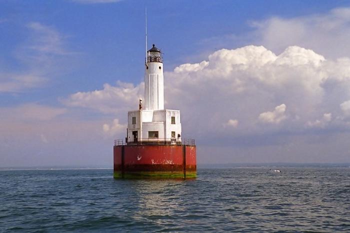
It sits in shallow water on the eastern of the two halves of Cleveland Ledge, which is said to have been named for President Grover Cleveland because he used to fish in the area. It marks the east side of the beginning of the dredged channel leading to the Cape Cod Canal and is the first fixed mark when going northbound through the canal. As it is an important mark in an area subject to fog, it has a racon showing the letter "C".
It was added to the National Register of Historic Places as Cleveland Ledge Light Station in 1987.
lighthouse.cc/clevelandledge/index.html
It was added to the National Register of Historic Places as Cleveland Ledge Light Station in 1987.
lighthouse.cc/clevelandledge/index.html
Wikipedia article: http://en.wikipedia.org/wiki/Cleveland_East_Ledge_Light
Nearby cities:
Coordinates: 41°37'51"N 70°41'39"W
- Beavertail State Park 62 km
- Mount Desert Rock Lighthouse 334 km
- Baker Island - Acadia National Park 355 km
- Île Ste-Thérèse Upper Range 502 km
- Contrecoeur-Verchères Range 515 km
- Port Saint-François Range 540 km
- Bécancour Range 547 km
- Gentilly Range 549 km
- Pointe des Grondines Range 563 km
- Rivière Valin Range 761 km
- Mattapoisett, Massachusetts 7.7 km
- Marion, Massachusetts 8.6 km
- Quisset Harbor 10 km
- Town of Falmouth, Massachusetts 10 km
- Woods Hole Golf Club 11 km
- West Island 12 km
- Penzance Point 12 km
- Town of Fairhaven, Massachusetts 14 km
- Naushon Island 17 km
- Gosnold, Massachusetts 21 km