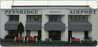
Pennridge Airport (KCKZ)
USA /
Pennsylvania /
Perkasie /
N Ridge Road, 1100
World
/ USA
/ Pennsylvania
/ Perkasie
World / United States / Pennsylvania
airport, skydiving
Airport Identifier: CKZ
Elevation: 568 ft / 173.13 m (Surveyed)
Land: 270 acres
From nearest city: 1 nautical miles N of Perkasie, PA
Location: Bucks County, PA
Magnetic Variation: 12W (1985)
Pennridge Airport (ICAO: KCKZ, FAA LID: CKZ, formerly N70) is a public use airport located one nautical mile (1.85 km) north of the central business district of Perkasie, a borough in Bucks County, Pennsylvania. It is privately owned by Pennridge Development Ent., Inc.[1] The airport is situated in East Rockhill Township.
The airport is located on top of a ridge and is surrounded on every side by trees. Although the daily operations are under 100 takeoffs/landings, it is the largest privately owned airport between Philadelphia and Allentown.
1100 N Ridge Road, Perkasie, PA 18944
Ridge Road, Perkasie, PA 18944
(215) 257-0166
www.pennridgeairport.com/default.htm
www.airport-data.com/airport/CKZ/
www.globalair.com/airport/airport.aspx?aptcode=KCKZ
Wikipedia article: http://en.wikipedia.org/wiki/Pennridge_Airport
Nearby cities:
Coordinates: 40°23'21"N 75°17'26"W
- Lehigh Valley International Airport (ABE/KABE) 34 km
- Philadelphia International Airport (PHL/KPHL) 55 km
- McGuire Air Force Base (WRI/KWRI) 69 km
- New Castle Airport (KILG/ILG) 83 km
- Morristown Municipal Airport (MMU) 87 km
- Newark Liberty International Airport (EWR/KEWR) 99 km
- Atlantic City International Airport 118 km
- Floyd Bennett Field (NOP) 120 km
- John F. Kennedy International Airport (JFK/KJFK) 128 km
- Dover Air Force Base (KDOV/DOV) 139 km
- Perkasie, Pennsylvania 2.1 km
- Sellersville, Pennsylvania 3.6 km
- West Rockhill Township 5.7 km
- Hilltown Township 6.2 km
- Quakertown, Pennsylvania 7.2 km
- Lake Nockamixon / Nockamixon State Park 9 km
- New Britain Township 11 km
- Bucks County, Pennsylvania 17 km
- Montgomery County, Pennsylvania 21 km
- Lehigh County, Pennsylvania 36 km