RandstadRail
Netherlands /
Zuid-Holland /
s-Gravenhage /
World
/ Netherlands
/ Zuid-Holland
/ s-Gravenhage
World / Netherlands / Zuid-Holland
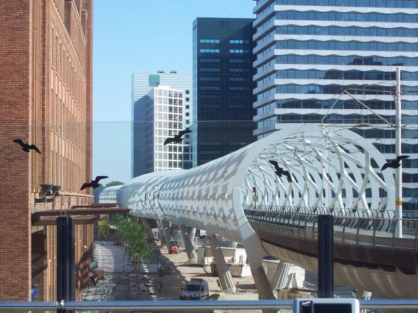
Urban transportation network. Linking The Hague tramways with the Rotterdam Metro.
Wikipedia article: http://en.wikipedia.org/wiki/Randstadrail
Nearby cities:
Coordinates: 52°4'46"N 4°20'8"E
- Landgoed Oostduin 2.4 km
- Landgoed Arendsdorp 2.4 km
- Clingendael and Japanese garden 2.7 km
- Arendsdorp 2.9 km
- International Crime Court (New building) 3.4 km
- Camping Duindigt 3.7 km
- Frederik Hendriklaan, Den Hague 4.6 km
- Antennafield Scheveningen Radio 6 km
- Sportpark Craeyenhout / Sportpark HBS Craeyenhout (HBS Craeyenhout) / Sportpark Daal en Bergselaan, The Hague, Netherlands 6.5 km
- Bohemen-Rechts 7.1 km
- Binckhorst 1.3 km
- The Hague Downtown 1.9 km
- The Hague (municipality) 2.2 km
- Scheveningen 4.1 km
- Leidscheveen-Ypenburg 4.5 km
- Rijswijk 4.8 km
- Leidschendam-Voorburg 5.5 km
- Escamp 6 km
- Westland (Municipality) 12 km
- South Holland 15 km