Apsley Falls
Australia /
New South Wales /
Armidale /
World
/ Australia
/ New South Wales
/ Armidale
World / Australia / New South Wales
waterfall
Add category


The Apsley Falls are situated about 20 km east of the New England township of Walcha NSW on the River of the same name. The river snakes its way through the New England Plateau before finally reaching the Pacific Ocean at South West Rocks.
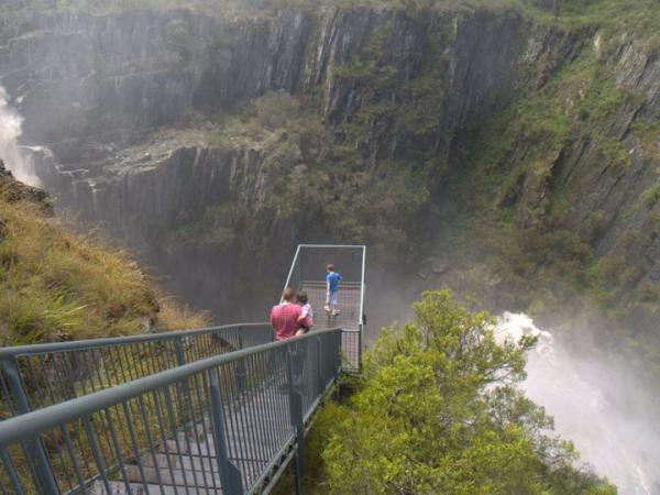
The falls consist of two drops; the first one is around 65metres and the second just under 60metres. The first drop is accessible from the car park at the top of the falls just off the Oxley Highway. The second falls can be see from the far side of the gorge.
Over the millennia, the river has cut its way through the slate creating an extremely deep trench with almost sheer vertical sides.
The photos I have atttached to this page were taken just after a particularly large rainfall in late November 2008. Around 60mm of rain fell in just a few hours causing the falls to flow at a furious rate. Locals said that the falls are rarely that active.
Wikipedia article: http://en.wikipedia.org/wiki/Apsley_Falls
Nearby cities:
Coordinates: 31°3'0"S 151°46'12"E
- Falls Creek 769 km
- Steavenson Falls 908 km
- Wilhelmina Falls 908 km
- Doone Falls - Rocky Cape National Park, Tasmania 1231 km
- Wallaman Falls 1512 km
- Barron Falls 1700 km
- Wairere Boulders 2084 km
- Ananui Falls 2319 km
- Waterfall 3108 km
- Waterfalls on Wabudori River 3784 km
- Apsley River Gorge 2.2 km
- Chaffey Dam 70 km
- Tamworth Airport (YSTW) 88 km
- Quarry 88 km
- Duri Mountain 101 km
- Lake Keepit Soaring Club 120 km
- Lake Keepit 121 km
- Burning Mountain 123 km
- Breeza 126 km
- The Pinnacle (or Warrah View) 129 km