Hoşap Castle (Güzelsu)
Turkey /
Van /
Baskale /
Güzelsu
World
/ Turkey
/ Van
/ Baskale
World / Turkey / Van
castle, place with historical importance, archaeological site, fortress, listed building / architectural heritage, historic landmark


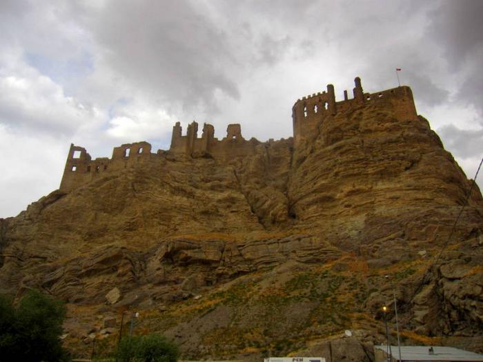


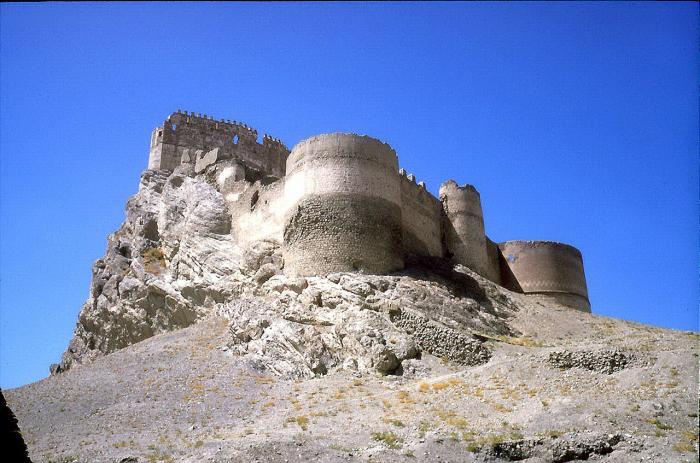
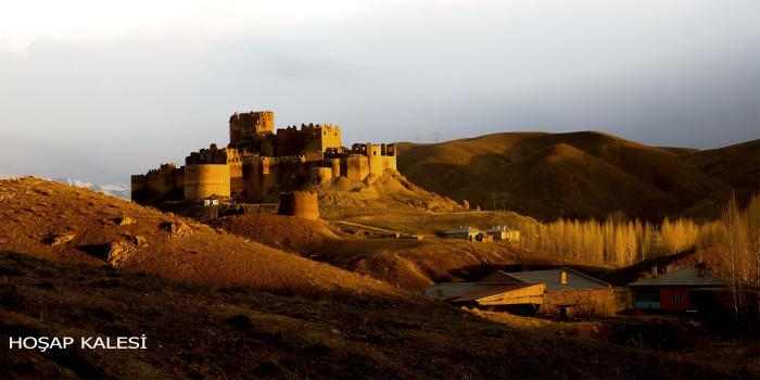
Hoşap Castle (Turkish: Hoşap kalesi) is a large medieval castle in the village of Hoşap (literally in Kurdish meaning: Good or Sweet Water), official name Güzelsu, located in southeastern Turkey. Most of the surviving structure was built by a local Kurdish lord named Mahmudi Suleyman in 1643.
The former town of Hoşap lay on the flat ground north of the castle rock and in the enclosed space on the opposite side of the castle from the road; the present village extends into this space. The town was defended at one corner by the castle and elsewhere by a wall, which originally started from the ends of the castle’s two cliffs. Built of mud, and toothed with the remains of mud battlements, the wall of the early Ottoman period can still be seen in stretches.
On the north of the former town it now starts from a point beyond but the line of the cliff, near the Van road and extends along a natural ridge eastwards. From the castle’s southerly cliff the wall crosses the low saddle to the north-east. The two walls meet at the summit of the next hill, in order to keep control of all the land commanding the town. Beyond this hill’s summit stretches a seemingly empty expanse of low, spreading hills.
Aerial view filmed by a drone - travelwithdrone.com/hosap-castle/
Wikipedia article: http://en.wikipedia.org/wiki/Hoşap_Castle
Nearby cities:
Coordinates: 38°19'1"N 43°48'5"E
- Ancient City of Ercis 83 km
- Mardin Fortress 292 km
- Diyarbakir/Amed Citadel 316 km
- Balahovit Fortress 338 km
- Husn al-Qadisiya (al-Mubarak) Fortress 469 km
- Divriği Kalesi 506 km
- Սիս / Sis (Sso Berd) 709 km
- Al-Husn 780 km
- Famagusta Castle and Walls, Surici Neighbourhood 949 km
- Arsuf Stronghold - aka Arsur or Apollonia; a Crusader castle 1063 km
- Aşağı Mahalle 4.1 km
- Kırağı 4.1 km
- Albenek 5.4 km
- Kalegör 6.1 km
- Mustafabey 7.7 km
- Aşağı Mahalle 9 km
- Toygun 12 km
- Çakır 12 km
- Göresirne 12 km
- Çılgı 13 km