Ibirité
Brazil /
Minas Gerais /
Ibirite /
World
/ Brazil
/ Minas Gerais
/ Ibirite
World / Brazil / Minas Gerais / Ibirité
city, municipality, draw only border
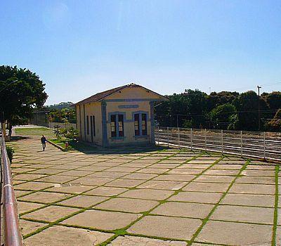


Ibirité came about in 1890 as a village name Vargem of Pantana, in the parish of Sabara. This village was later chosen by Russian educator Helena Antipoff to be the seat of his works that are still the major benchmark in the city. In 1890, it became a village, also belonging to Sahara. In 1897 he became part of the municipality of Santa Quitéria currently Esmeraldas. In 1911, the region becomes part of the municipality of Betim. In 1923, its name has changed to Ibirité Indian word which means land. In 1938, passes to the rank of district belonging to the municipality of Betim, figuring its current name. On December 30, 1962, is the category of municipality, districts and headquarters Sarzedo. The March 1, 1963 Chaffer Ferreira is appointed by the governor of the state as municipal mayor. In the first mayoral election, the June 30, 1963, when he was elected Wanderlei Jose de Barros. In 1976, the district was created by Durval de Barros in 1985 and the District of Mario Campos. In 1988, the State Law No. 954888, won the category Ibirité county.
Wikipedia article: http://pt.wikipedia.org/wiki/Ibirité
Nearby cities:
Coordinates: 20°1'24"S 44°4'6"W
- São João del-Rey 125 km
- Juiz de Fora 160 km
- Itaperuna 225 km
- Governador Valadares 245 km
- São Fidélis 271 km
- Aimores 285 km
- Domingos Martins 307 km
- Baixo Guandu 315 km
- Colatina 345 km
- Nova Viçosa 490 km
- Bairro Nossa Senhora de Lourdes 2.4 km
- School SESI Hamleto Magnavacca 3.9 km
- From Lake Ibirité 4.1 km
- School 4.4 km
- Electrical sub-station 4.8 km
- Electrical sub-station 6.2 km
- Barreiro 6.4 km
- Barreiro de Baixo 7 km
- AMazonas 7.1 km
- BLAO Empreendimentos e Participações 7.9 km