Toul-Rosières Solar Field
| solar power station / farm (photovoltaic)
France /
Lorraine /
Rosieres-en-Haye /
D907
World
/ France
/ Lorraine
/ Rosieres-en-Haye
France / World / Lorraine / Meurthe-et-Moselle / Toul / Domèvre-en-Haye
solar power station / farm (photovoltaic)
Add category
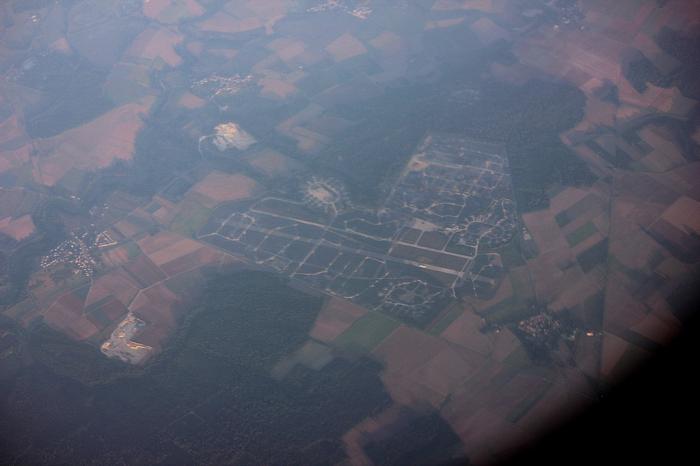
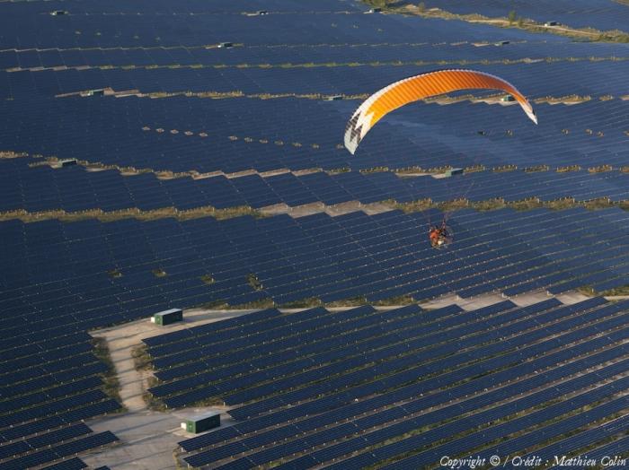
Area: 522 ha. Operating since Oct-12
wiki-solar.org/map/world.html
Former French BA 136 Toul-Rosières airforce base. At first, TRAB, Toul-Rosières Airforce Base, was a US Air Force European base, then became a French base in 1967. It's now been officially closed since August 34st, 2004. On May 14, 2011, the last day of operation was celebrated before the destruction of the premises can begin.
The TRAB 136 non-profit association was founded by the veterans of the base. Two Facebook groups can be accessed.
Wikipedia article: http://en.wikipedia.org/wiki/Toul-Rosières_Air_Base
Nearby cities:
Coordinates: 48°46'53"N 5°58'44"E
- Solar Field. Former QRA position 222 km
- Solar Farm 290 km
- Solar field 327 km
- Solar field 328 km
- Solar Farm 366 km
- Solar field 367 km
- Solar field 378 km
- Moorenweis Solar Field 381 km
- Solar field 382 km
- Solar power plant 498 km
- Water tower 1.6 km
- Water tower 5.4 km
- Water tower 5.4 km
- Chalets de Finnlande 5.4 km
- Frouard Hydropower station 11 km
- Bridal Shop 13 km
- Used Car Dealer 13 km
- Neon Sign Shop 13 km
- Echangeur autoroute A31 / autoroute A33 14 km