Brtonigla-Verteneglio
Croatia /
Istra /
Brtonigla /
World
/ Croatia
/ Istra
/ Brtonigla
World / Croatia / Istarska
municipality, settlement
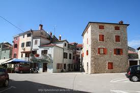
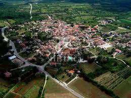

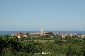
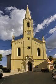

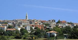
Brtonigla (Italian: Verteneglio) is a village and municipality in the north-western part of Istria, Croatia, 6 km southwest of Buje; elevation 141 m. It is close to the A9 motorway. Chief occupations include farming, viniculture and vegetable growing.
Wikipedia article: http://en.wikipedia.org/wiki/Brtonigla
Nearby cities:
Coordinates: 45°22'41"N 13°37'33"E
- Tar 7.9 km
- Tar-Vabriga 7.9 km
- Kaštelir-Labinci 9 km
- Višnjan 13 km
- Karojba 17 km
- Sveti Petar u Šumi 27 km
- Kanfanar 32 km
- Žminj 33 km
- Grignano - Grljan 38 km
- Hum 70 km
- Municipality of Brtongigla 2 km
- A9 - Exit Nova Vas 2.7 km
- A9 - Exit Buje 2.9 km
- Municipality of Buje 6 km
- Camping Park Umag 6.6 km
- Municipality of Novigrad 7.3 km
- Municipality of Umag 10 km
- sveti peter 10 km
- Municipality of Vižinada 14 km
- Gulf of Venice 53 km