Port de Pailhères
France /
Languedoc-Roussillon /
La Fajolle /
World
/ France
/ Languedoc-Roussillon
/ La Fajolle
France / World / Midi-Pyrénées / Ariège / Foix / Quérigut
mountain
Add category
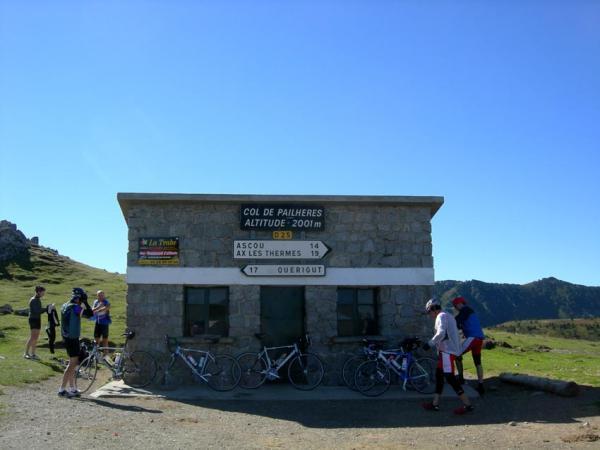
The Port de Pailhères or Col de Pailhères is a pass in the Ariège department of the French Pyrenees.
The summit is at an altitude of 2,001 metres, and is located on the secondary road D25 between Mijanès (south-eastern) and Ax-les-Thermes (western).
Starting from Mijanes, the Col de Pailhères is 10.6 km long. Over this distance, the climb is 871 m. (an average percentage of 8.2%) with a maximum gradient of 10.2%.
Starting from Ax-les-Thermes, the Col de Pailhères is 18.6 km long. Over this distance, the climb is 1281 m. (an average percentage of 6.9%) with a maximum gradient of 10.4% near the summit.
The climb has been used in four stages of the Tour de France cycle race in 2003, 2005, 2007 (14th stage) and 2010 (14th stage).
Wikipedia article: http://en.wikipedia.org/wiki/Port_de_Pailhères
Nearby cities:
Coordinates: 42°44'0"N 1°59'32"E
- Mountain Bugarach 34 km
- Mt. Canigou 43 km
- Aiguanegra 72 km
- Zona volcànica de la Garrotxa 72 km
- Sant Corneli 103 km
- Montserrat 126 km
- 22. Vallvidrera, el Tibidabo i les Planes (Sarrià - Sant Gervasi) 144 km
- Alpilles 248 km
- Mont Ventoux 308 km
- Mont Aiguille 370 km
- Centrale electrique d'Orlu, 912 metres. 8.2 km
- Railway tunnel 15 km
- Pic d'Auriol 18 km
- Lake Lanoux 18 km
- Lanoux Dam 19 km
- Railway tunnel 20 km
- Lac de Matemale 20 km
- Railway tunnel 22 km
- Snowkite spot 24 km
- Andorra 39 km