Strongyli
Turkey /
Antalya /
Kas /
World
/ Turkey
/ Antalya
/ Kas
World / Turkey / Antalya
island
Add category
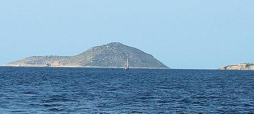
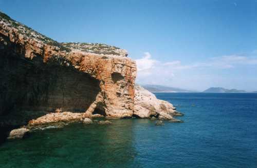

Strongyli Meyistis (Greek: Στρογγυλή Μεγίστης), also called plainly Strongyli or Ypsili, is a Greek islet which lies in the eastern Mediterranean Sea, about four kilometers south-east of the island of Kastellorizo. The island is about 1.5 kilometres (0.9 miles) long+up to 700 metres (2,300 ft) wide. It covers an area of about 0.9 square kilometres (0.3 sq mi). It is rather flat+covered with macchia. The islet has no permanent residents.
Strongyli is the easternmost Greek territory. Administratively it is part of the Municipality of Megisti. According to the 2011 census the island is deserted. It has a lighthouse, which has the characteristic of being the easternmost building in Greece. The Turkish name for the island is Çam Adası (English: Pine island).
MAJOR EEZ+12 nautical miles geostrategical Hellenic sea ground in Greek territorial waters of Aegean+Eastern Mediterranean seas.
Also no.1 strategic goal of the turco-barbaric future military attack+occupation...
Wikipedia article: http://en.wikipedia.org/wiki/Strongyli_Megistis
Nearby cities:
Coordinates: 36°6'49"N 29°38'12"E
- Kovan 4.6 km
- Meyisti (Kastellorizo) 9 km
- Iç Island 10 km
- Rho Island 14 km
- Kekova Island 21 km
- Sıçan Adası 27 km
- Five Islands (Beş Adalar) 69 km
- Gemiler Island 71 km
- Water Island (Sulu Ada) 76 km
- Three Islands, Üç Adalar 90 km
- Electric Power Station 4.5 km
- Mandraki gulf 5.2 km
- Kastelorizo bay 5.8 km
- Kastellorizo Airport 6.3 km
- water storage 6.3 km
- Runway 13/31 6.3 km
- Greek Kastellorizo Military Base 6.4 km
- Sebeda (Lycian) 6.5 km
- Limanagzi Bay 7.2 km
- Antalya Province 137 km